Ice Tethered Profiler 7 Data Data from ITP7 deployed in April 2007
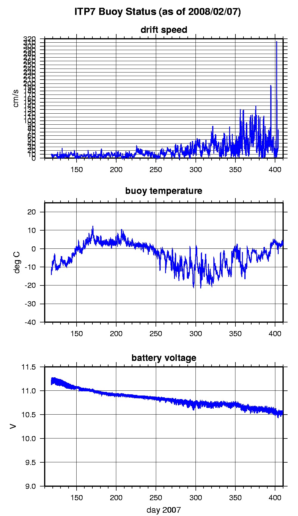
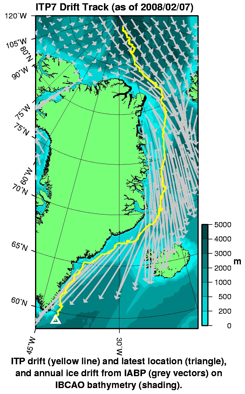
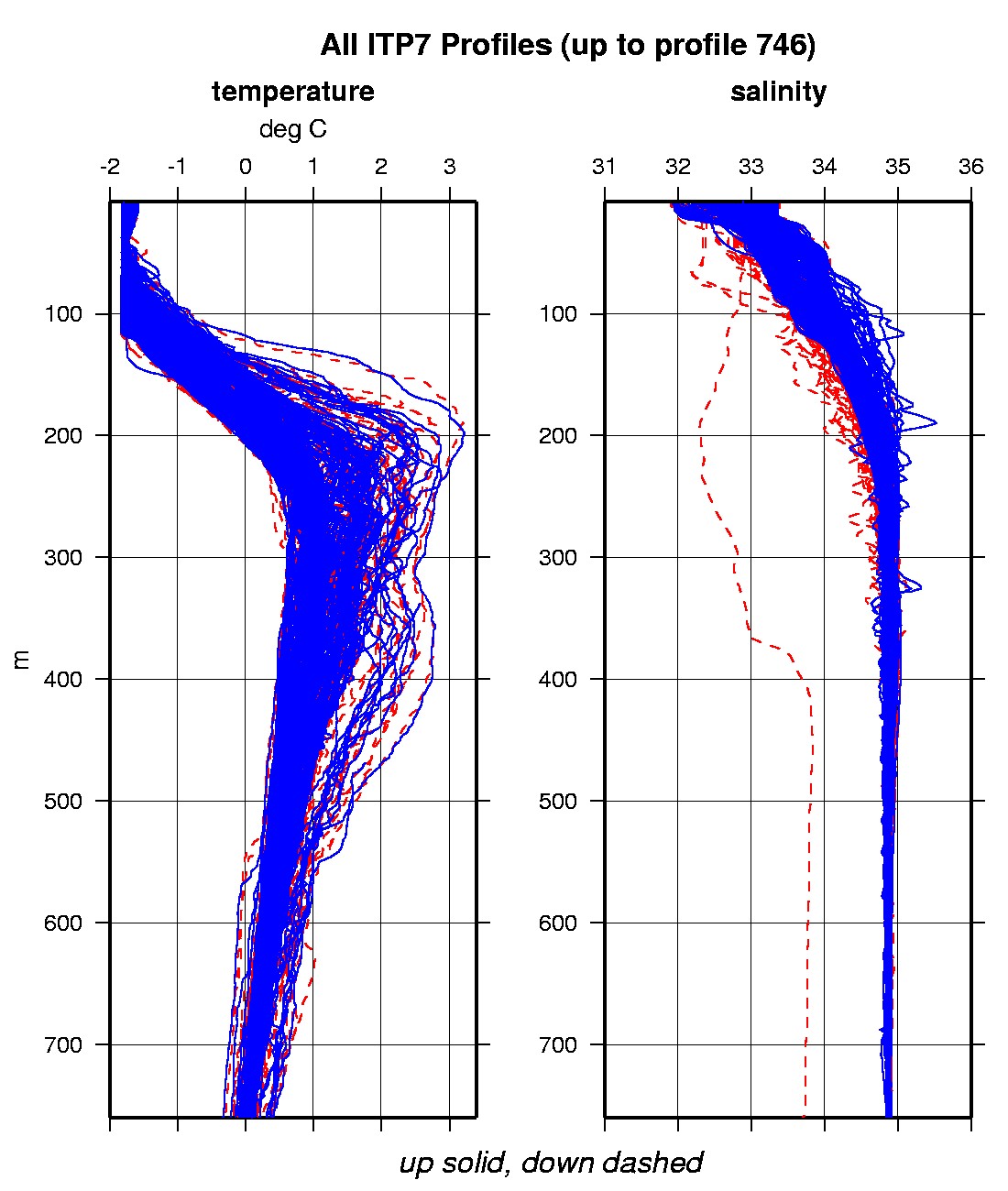
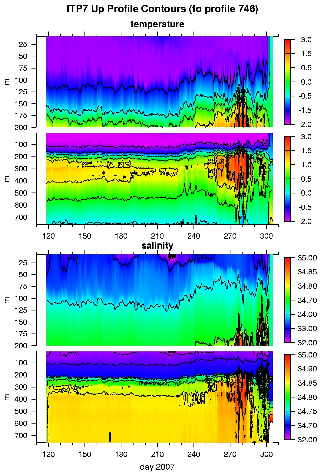
Last buoy status on 2008/9/29 230001 UTC : temperature = 14.48 °C, battery = 10.59 V Last position on 2008/2/7 220022 UTC : 59.1536° N, 41.8365° W Last profile (number 746) on 2007/11/1 0 UTC Last profile mean motor current = 324.4039 mA, mean battery = 9.9197 V Last profile depth: minimum = 202.6442, maximum = 209.18 m Last profile temperature: minimum = 2.2384, maximum = 2.26 °C Last profile salinity: minimum = 4.3369, maximum = 4.3711 The raw GPS buoy location data are available in an ASCII file: itp7rawlocs.dat Depth averaged profiler data files (with interpolated location) are available in two formats: ITP7 was deployed on a 2.5 m thick icefloe in the Transpolar Drift on April 28,2007 at 88.810°N, 12.513°W as part of the North Pole Environmental Observatory (NPEO) . On the same icefloe, a Naval Postgraduate School Arctic Ocean Flux Buoy (AOFB) and Climate Change College meteorological mast were also installed. On a seperate icefloe approximately 1 km away, a US Army Cold Regions Research and Engineering Laboratory (CRREL) Ice Mass Balance Buoy (ARC 5756) and NOAA/PMEL Weatherex station were deployed. The ITP is operating on a fast sampling schedule of 4 one-way profiles between 7 and 760 m depth each day.
|