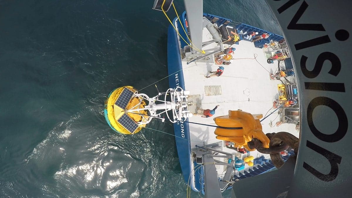
 The Ocean Observatories Initiative is moving full speed ahead at Woods Hole Oceanographic Institution. This unprecedented ocean science project is streaming a wealth of marine data straight from the ocean to the World Wide Web, making it free for anyone to use. In the image above, an OOI coastal surface buoy is recovered from the ocean and hoisted onto the fantail of the research vessel Neil Armstrong. (Photo by Paul Matthias, Woods Hole Oceanographic Institution)
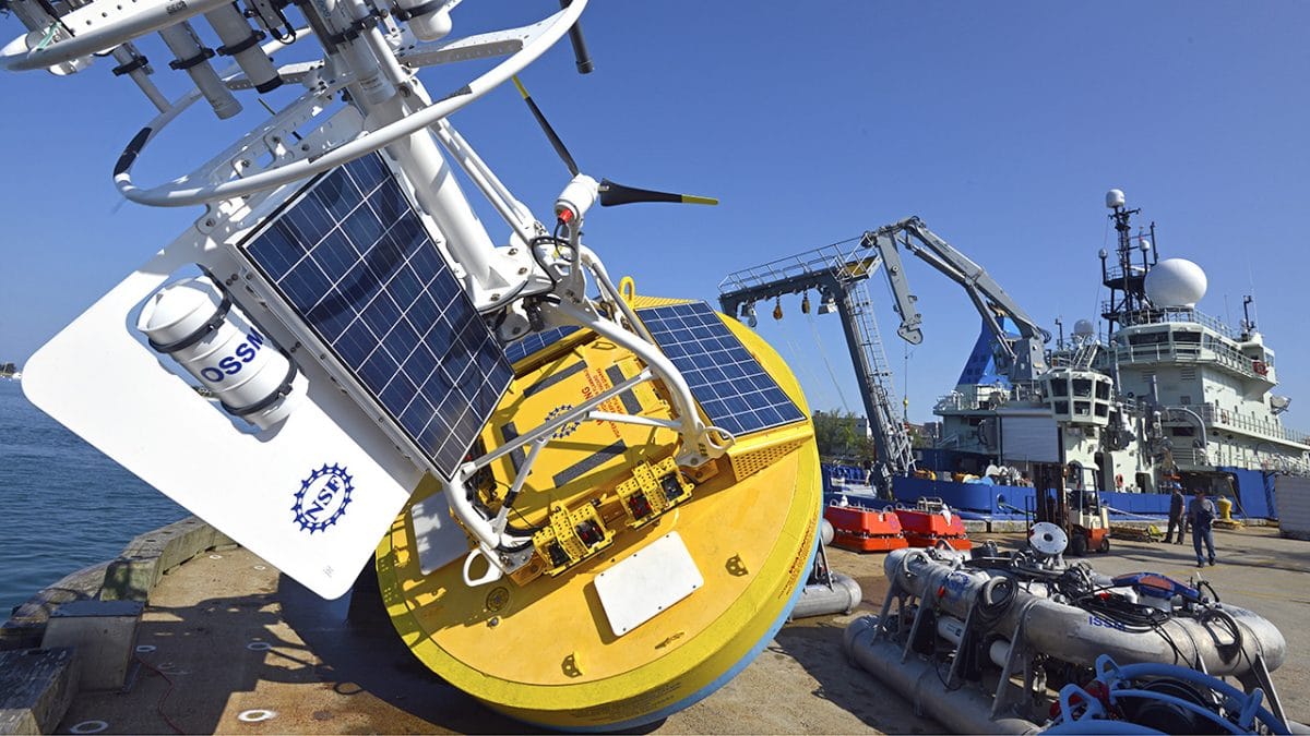
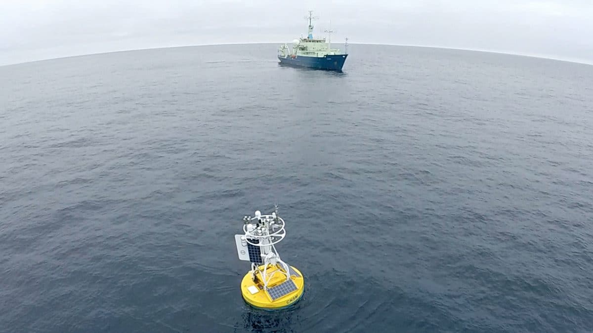
- Moorings, some with large blue-and-yellow surface buoys, serve as platforms for scientific instruments and are a key component of the OOI’s arrays. Instruments are attached to the surface buoy to observe the marine atmosphere, and to the anchor frame and interconnecting cable to make measurements of the physical, chemical, and biological properties of the ocean. Unlike sampling devices and sensors deployed from ships, the instruments on a mooring operate all day, every day, transmitting data to shore in near-real time. And unlike orbiting, satellite-based sensors, which cannot penetrate much beneath the ocean’s surface, moored instruments capture measurements from the surface all the way down to the ocean floor. (Photo by Ken Kostel, Woods Hole Oceanographic Institution)
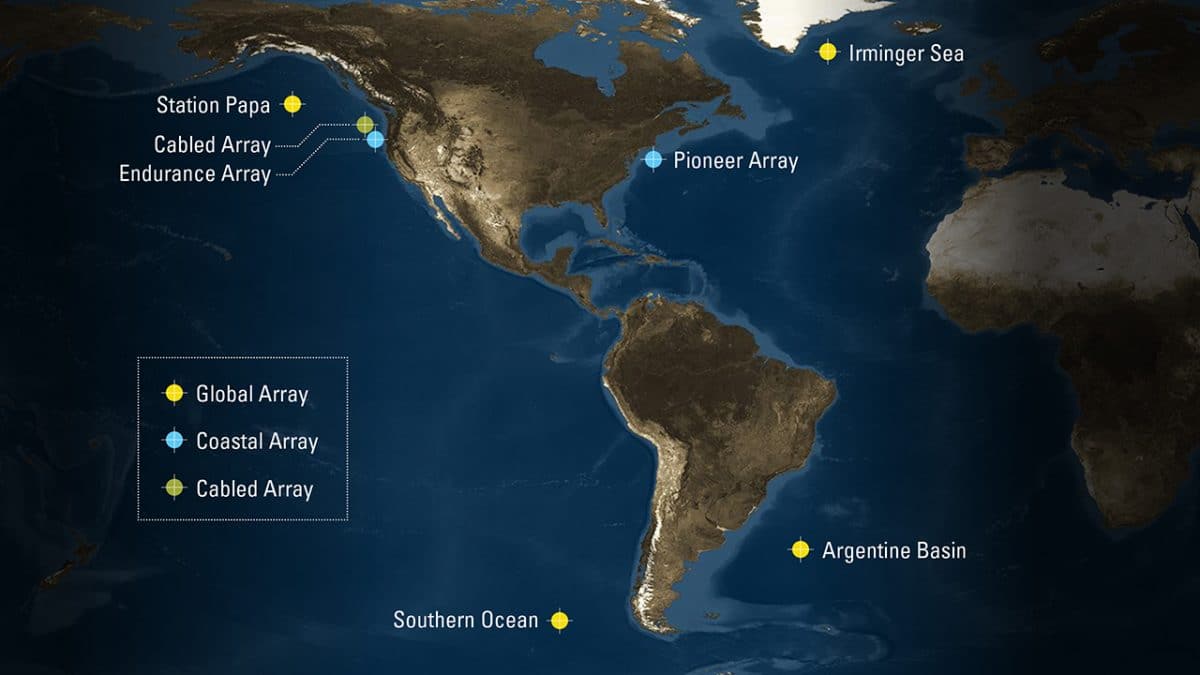
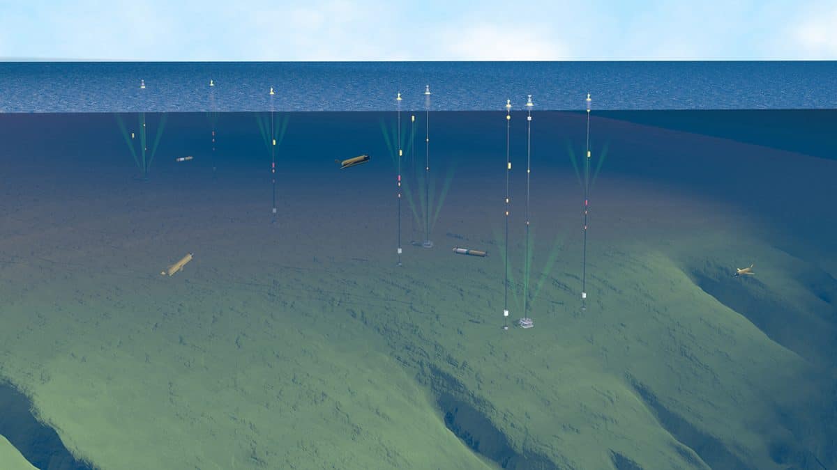
- The OOI includes four high-latitude Global Arrays near Alaska, Argentina, Chile, and Greenland; two Coastal Arrays—one off New England, the other off the Pacific Northwest; and a Cabled Array running to the Oregon coast from an active submarine volcano about 300 miles offshore. WHOI designed, built, and operates five of the seven arrays: the four Global Arrays and the Coastal Pioneer Array. (Illustration by Jack Cook and Eric Taylor, WHOI Graphic Services)
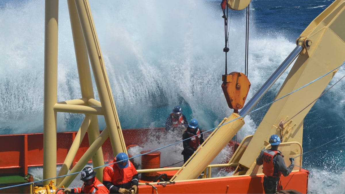
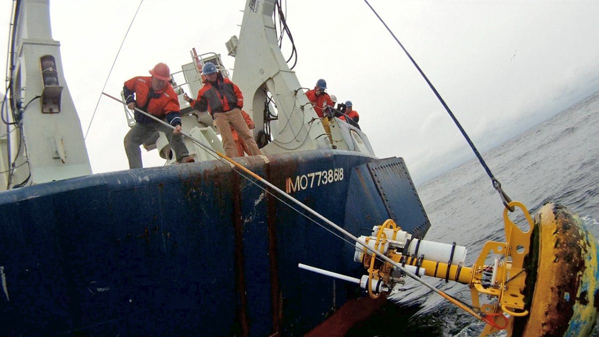
- For scientists and ships’ crews, maintaining equipment at OOI arrays can mean confronting fierce weather, strong ocean currents, and massive waves. This one drenched people working on the deck of the Nathaniel B. Palmer during a WHOI-led scientific mission to the Global Argentine Basin Array in November 2015. (Photo by Mitch Elend, University of Washington)
- The Coastal Pioneer Array consists of three types of moorings, ocean gliders, and autonomous underwater vehicles, making it one of the most complex arrays in the OOI network. The moored array spans more than 160 square miles across the sloping edge of New England’s continental shelf. The biologically productive “shelf break” is of particular interest to scientists: it represents a transition zone between relatively fresh, nutrient-poor water near shore and saltier, nutrient-rich water in the deep ocean. But the Pioneer Array won’t stay off New England forever—the plan is to move it to a different coastal region in five years. (Illustration by Jack Cook, WHOI Graphic Services)
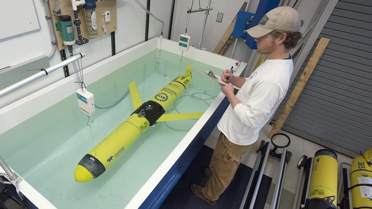
- The OOI is not just made up of instrument systems anchored to the sea floor. Ocean gliders such as this one move between and beyond the moorings for months at a time, measuring temperature, salinity, and other critical ocean properties that help scientists understand what is happening far beyond the anchored moorings. The vehicles have no motor: they literally glide through the water by changing their buoyancy. This glider is having its buoyancy tested in the lab prior to deployment at sea. Once the vehicles are deployed, glider pilots at WHOI test and monitor the gliders remotely and can reprogram them to keep them on course or to investigate oceanographic features of interest. (Photo by Tom Kleindinst, Woods Hole Oceanographic Institution)
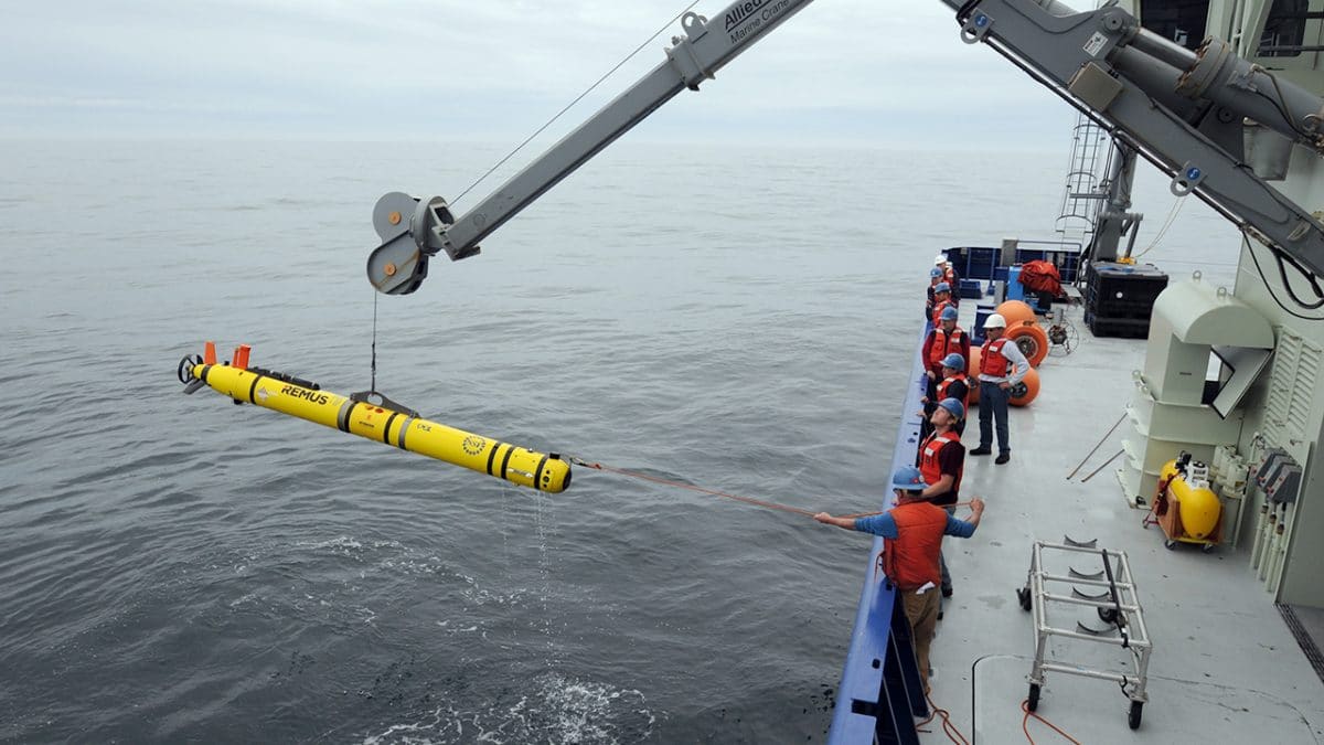
- In addition to gliders, scientists at the Pioneer Array use another type of mobile platform—the REMUS 600 autonomous underwater vehicle, or AUV—to carry out intensive, short-term investigations. Because REMUS AUVs are propeller-driven, they can move more quickly through the water than gliders, capturing high-resolution data on currents, nutrients, and other ocean properties. During a mission, scientists onboard a ship can communicate with a vehicle when it is submerged using an acoustic modem, or by satellite when it comes to the surface. (Photo by Véronique LaCapra, Woods Hole Oceanographic Institution)
- Salt water, waves, and marine life all take their toll on scientific equipment. To keep the Pioneer and Global Arrays functioning year-round, WHOI maintains two complete sets of every mooring, instrument, and vehicle. Once a year—twice, in the case of Pioneer—WHOI engineers and scientists travel to the arrays, pull everything out of the water, then deploy clean, repaired, and fully charged replacements. Maneuvering thousands of pounds of equipment in unpredictable waters takes considerable muscle, but also skilled coordination and long experience working at sea. (Photo by Ken Kostel, Woods Hole Oceanographic Institution)
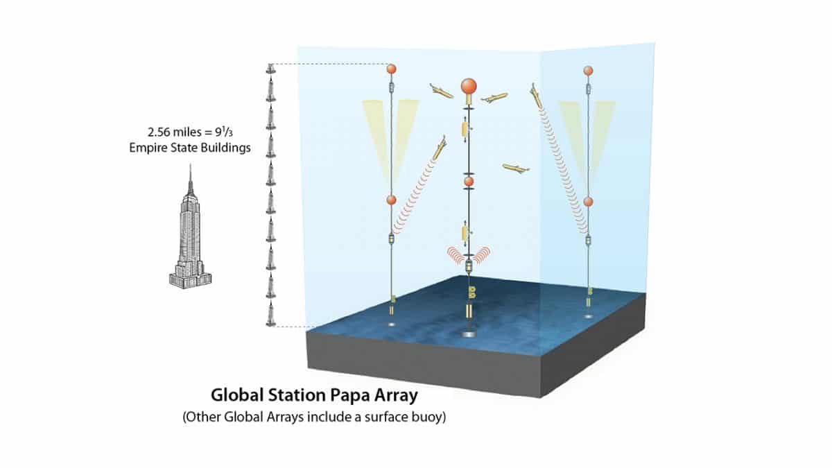
- Building and maintaining Global Arrays is an impressive feat of engineering. Moorings at these deep water arrays extend several miles to the ocean floor, making them especially challenging to design, deploy, and recover. They also extend the reach of scientists to parts of the ocean that are difficult to study any other way. (Illustration by Jack Cook, WHOI Graphic Services)
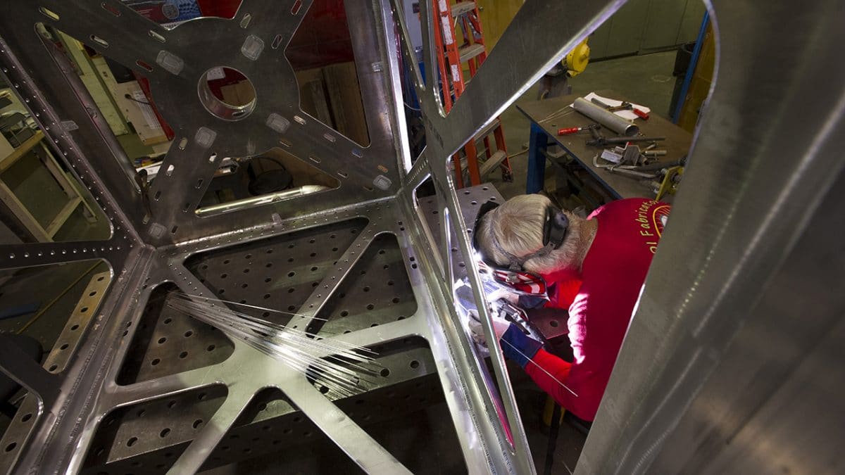
- From day one, WHOI has helped transform the OOI from vision to reality. WHOI’s engineers and technicians designed, built, and tested the project’s platforms and instruments to withstand storms, corrosion, shark bites, and other onslaughts of full-time deployment at sea. Now that the program has transitioned from build-out to full operation, WHOI’s job is to keep all the components of the Global and Pioneer Arrays in good working order. Here, a WHOI welder assembles the lower frame of a coastal surface mooring. (Photo by Tom Kleindinst, Woods Hole Oceanographic Institution)
- The OOI’s moorings, ocean gliders, and propeller-driven autonomous underwater vehicles aren’t just working around the clock to collect oceanographic data—they’re transmitting most of those measurements back to shore in near-real time, via the Iridium satellite network. The rest of the data are recovered when the instruments are brought in for servicing. Researchers, educators, and anyone else with access to an Internet connection can download the data for free using the OOI data portal. The information is already yielding scientific insights: WHOI researchers recently used data from an OOI glider to help reveal previously unknown marine circulation patterns at the edge of the continental shelf. (Photo courtesy of Kent Sheasley, Woods Hole Oceanographic Institution)
Ocean Observatories System Is Up and Running
WHOI plays major role in creating 'transformative' national research effort
The nation’s Ocean Observatories Initiative (OOI) has reached a major milestone: Its network of ocean sensor systems is now fully operational and sending a broad, continuous stream of data back to shore. Funded by the National Science Foundation with a planned life of 25 years, the OOI provides online access to a growing trove of multidisciplinary oceanographic data, freely available to researchers, educators, and the public worldwide.
From the OOI’s inception, Woods Hole Oceanographic Institution (WHOI) has been a major partner in the project, along with Oregon State University, Rutgers University, and the University of Washington. In 2009, WHOI began the design and construction of four Global Arrays deployed in remote high-latitude oceans near Alaska, Argentina, Chile, and Greenland, and the Coastal Pioneer Array, an observatory network that spans the continental shelf off New England. WHOI scientists and engineers travel to the arrays on a regular basis to deploy, maintain, and upgrade them, while WHOI personnel on shore control the infrastructure and download and monitor the data. In all, WHOI is responsible for more than half of the OOI’s arrays and instruments.
The OOI has established a long-term scientific presence in the ocean. The project represents the world’s largest investment in ocean science, consisting of 83 platforms, including anchored surface and profiler moorings, cabled moorings and seafloor sensors, remotely controlled ocean gliders, and autonomous underwater vehicles spread across seven arrays in the Atlantic and Pacific Oceans. In all, more than 830 instruments make physical, chemical, and biological measurements from above the water’s surface down thousands of feet to the ocean floor, operating around the clock, 365 days a year. These data are served up free-of-charge via the OOI data portal, many in near-real time.
To date, the NSF has invested $386 million to design, build, and purchase the OOI’s platforms and instruments, and to fund initial deployments. The OOI is a transformative program, providing ongoing data on climate change, ocean acidification, important ecosystems and the fisheries they sustain, and other ocean-related situations that pose societal challenges. OOI will also enable scientific discoveries for decades to come.
The images you see above show the magnitude of this scientific undertaking, and the breadth of cooperation and expertise needed to transform this visionary project into a successful tool used by oceanographers, teachers, and the general public.