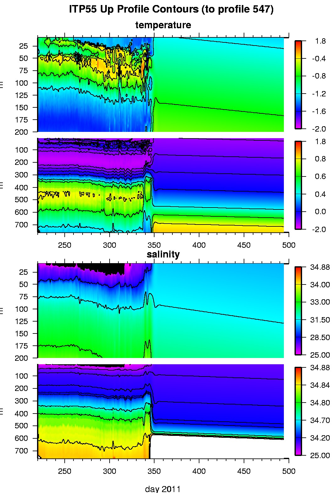
Ice Tethered Profiler 55 Data Data from ITP55 deployed in August 2011
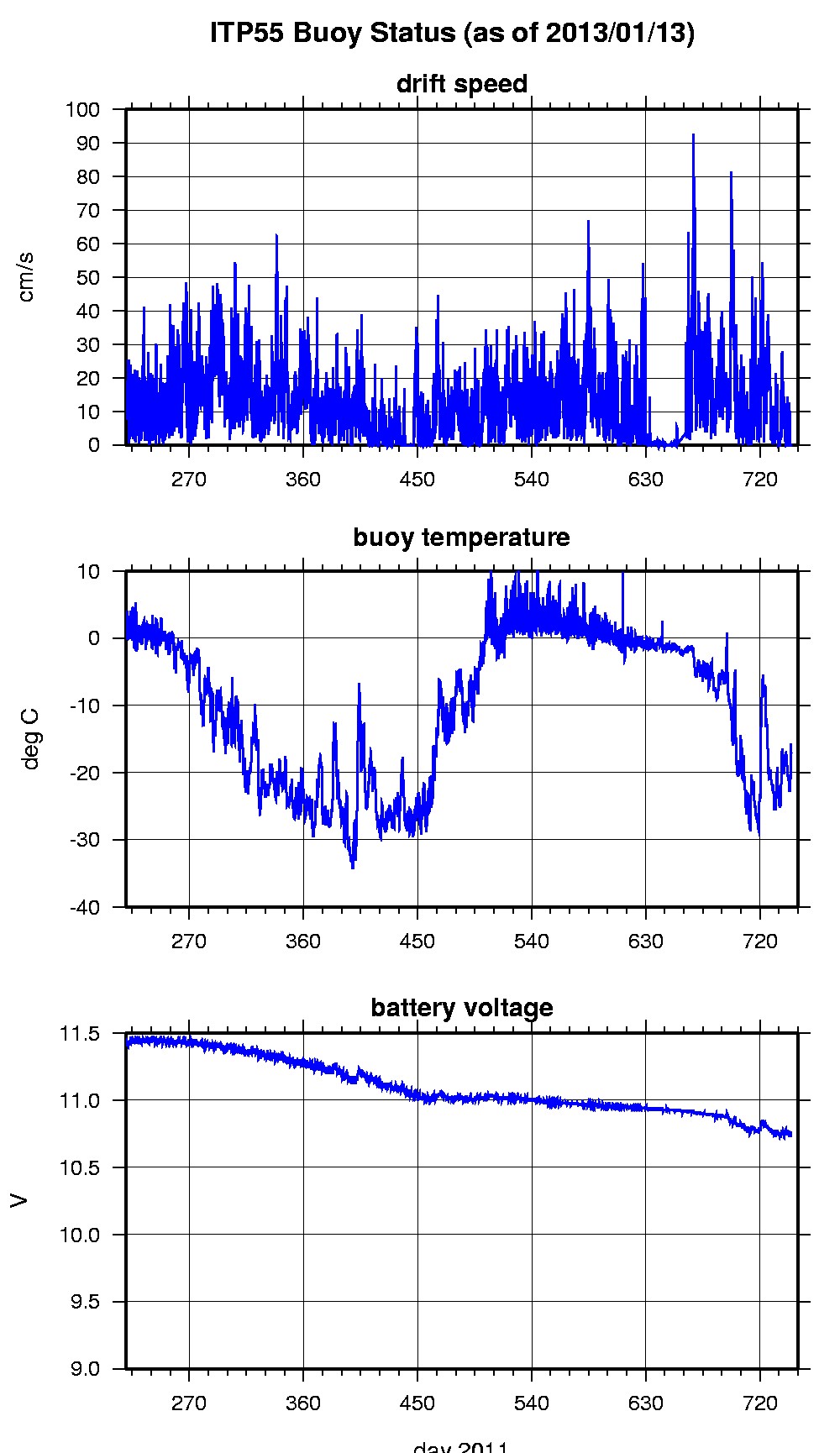
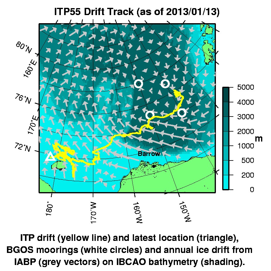
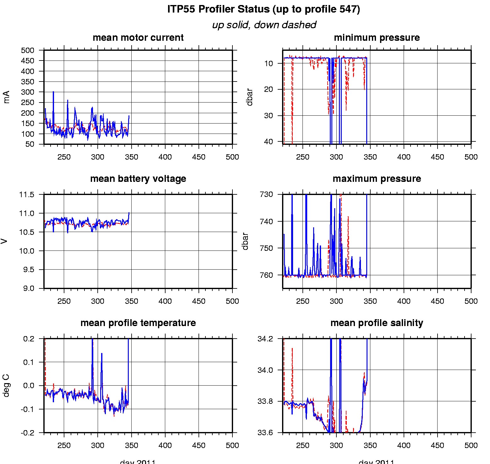
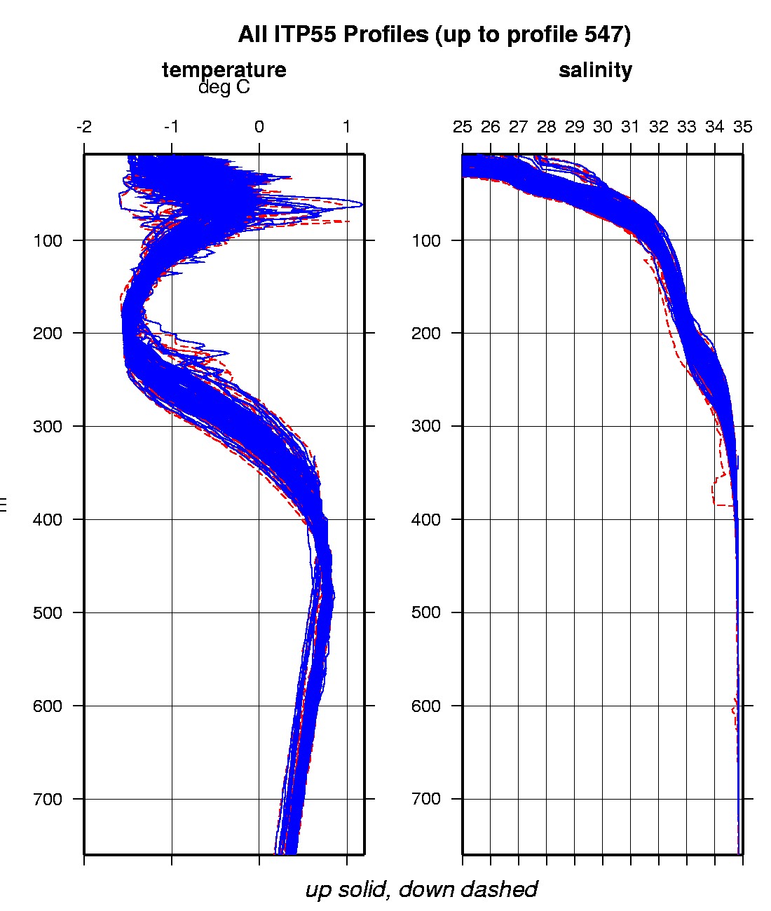
Last buoy status on 2013/1/13 230001 UTC : temperature = -17.03 °C, battery = 10.76 V Last position on 2013/1/13 220201 UTC : 71.7385° N, 177.8407° E Last profile (number 547) on 2012/5/8 24 UTC Last profile mean motor current = 55.9931 mA, mean battery = 10.8315 V Last profile depth: minimum = 40.6957, maximum = 40.6957 m Last profile temperature: minimum = -1.7896, maximum = -1.7896 °C Last profile salinity: minimum = 32.9584, maximum = 32.9584 The raw GPS buoy location data are available in an ASCII file: itp55rawlocs.dat Depth averaged profiler data files (with interpolated location) are available in two formats: ITP55 was deployed on August 8, 2011 on a 3.13 m thick ice floe in the Beaufort Sea at 76° 5.1 N, 138° 16.9 W as part of the Beaufort Gyre Observing System (BGOS) during the JOIS 2011 cruise on the CCGS Louis S. St. Laurent. On the same icefloe, a US Army Cold Regions Research and Engineering Laboratory (CRREL) Seasonal Ice Mass Balance Buoy (SIMB) and an Uptempo buoy were also installed. The ITP is operating on a typical sampling schedule of 2 one-way profiles between 7 and 760 m depth each day.
|