Ice Tethered Profiler 59 Data Data from ITP59 deployed in September 2013
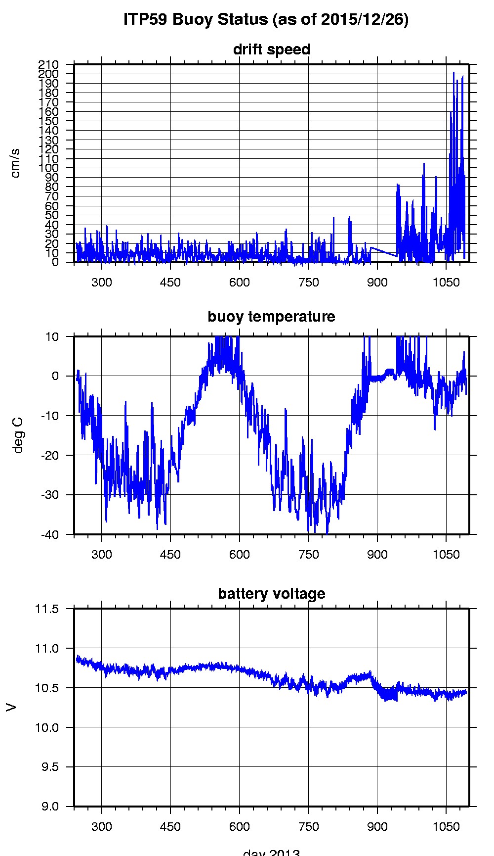
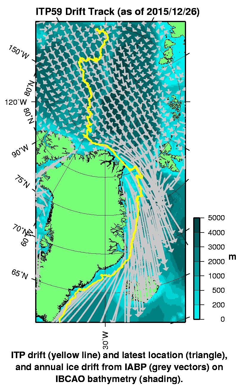
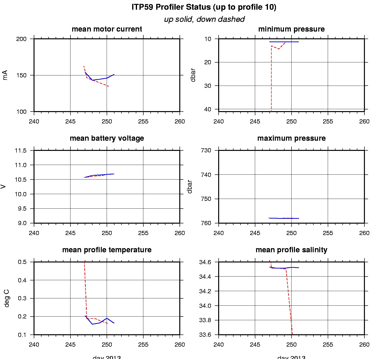
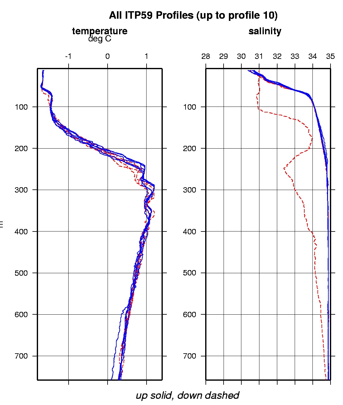
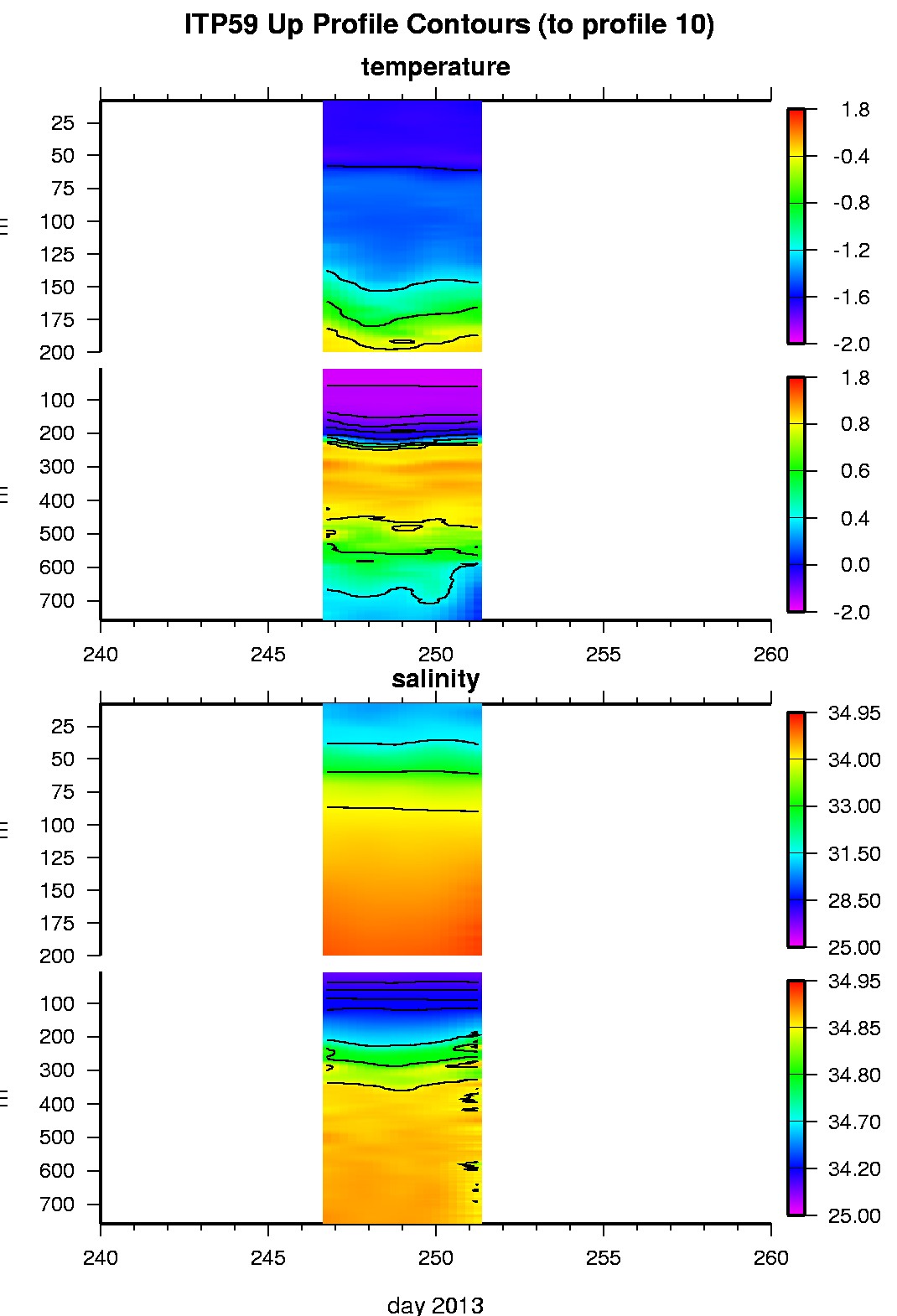
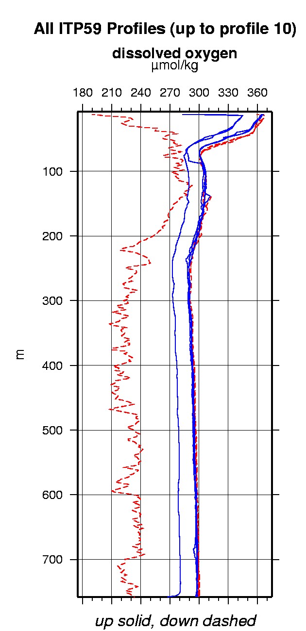
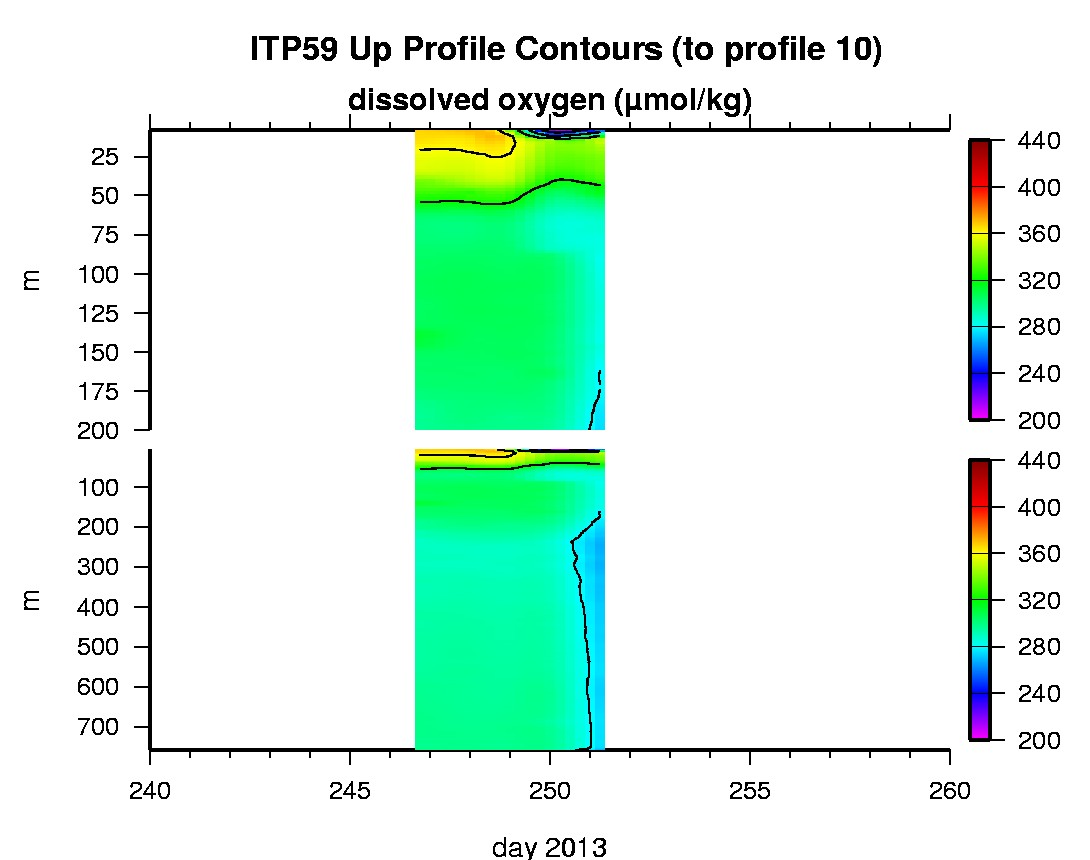
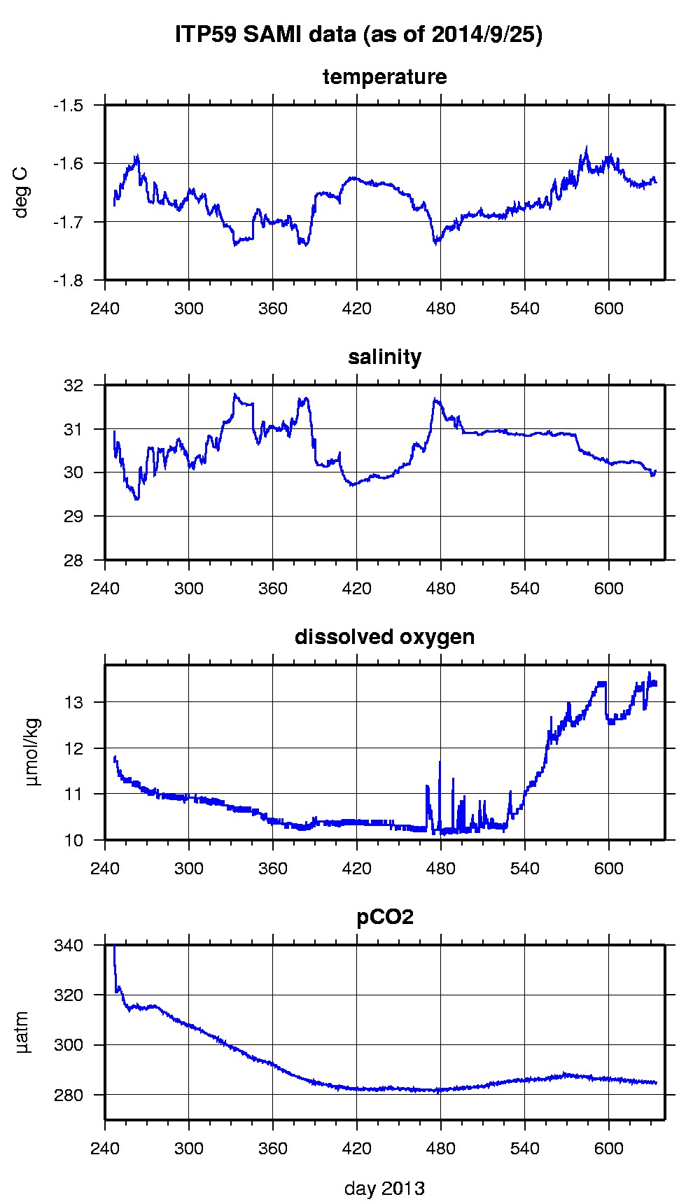
Last buoy status on 2015/12/28 230001 UTC : temperature = -4.66 °C, battery = 10.42 V Last position on 2015/12/26 60129 UTC : 59.8893° N, 43.4938° W Last profile (number 10) on 1995/8/15 531 UTC Last profile mean motor current = NaN mA, mean battery = NaN V Last profile depth: minimum = NaN, maximum = NaN m Last profile temperature: minimum = NaN, maximum = NaN °C Last profile salinity: minimum = NaN, maximum = NaN Last profile dissolved oxygen: minimum = NaN, maximum = NaN μmol/kg Last SAMI IMM transfer on 2015/6/3 15 UTC Last Microcat sample (number 4683) on 2014/9/25 193027 UTC Last temperature = -1.6342 °C, salinity = 30.0377 Last Optode sample (number 4683) on 2014/6/20 193022 UTC Last Dissolved Oxygen = 13.451 μmol/kg Last SAMI pCO2 sample (number 4683) on 2014/9/25 193016 UTC Last pCO2 = 284.9641 μatm The raw GPS buoy location data are available in an ASCII file: itp59rawlocs.dat Depth averaged profiler data files (with interpolated location) and time series SAMI data are available in two formats: ITP59 was deployed on a 1.5 m thick ice floe in the Transpolar Drift on September 3, 2013 at 80° 15.377 N, 155° 53.298 E in collaboration with the Nansen and Amundsen Basins Observational System (NABOS) project from the Russian Research Vessel Federov. The ITP includes a dissolved oxygen sensor and is operating on a standard sampling schedule of 2 one-way profiles between 7 and 760 m depth each day and a fixed SAMI PCO2 with SBE-37 microcat at 6 m depth.
|