Ice Tethered Profiler 84 Data Data from ITP84 deployed in October 2014
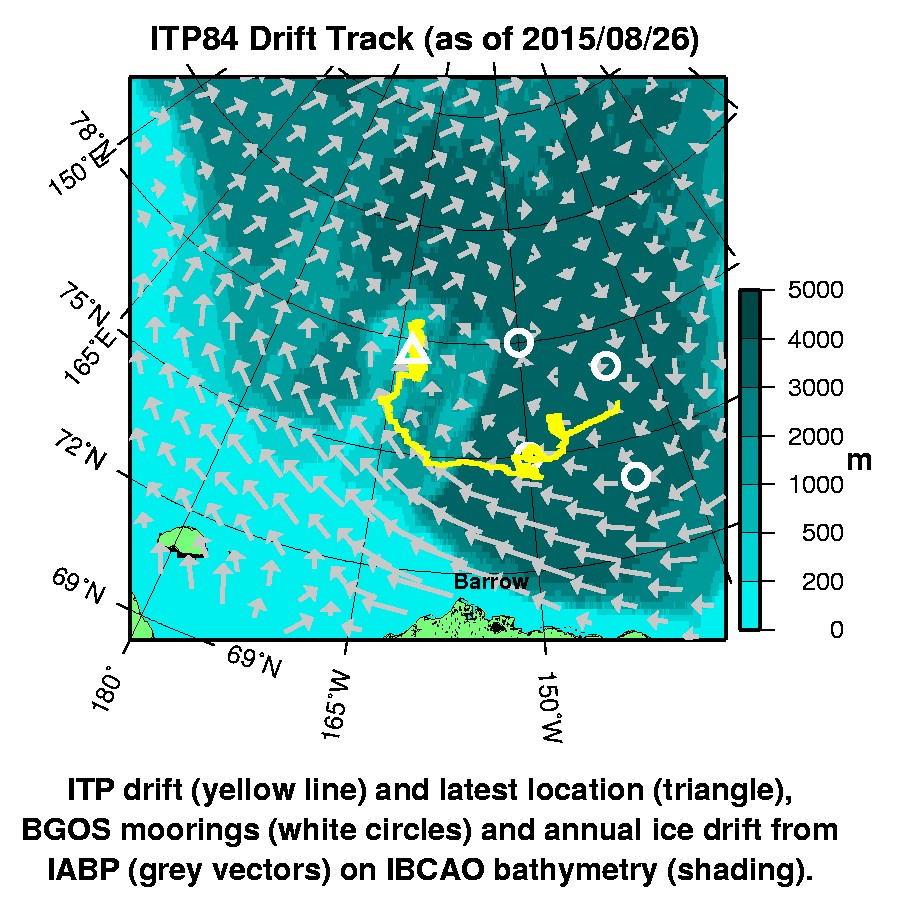
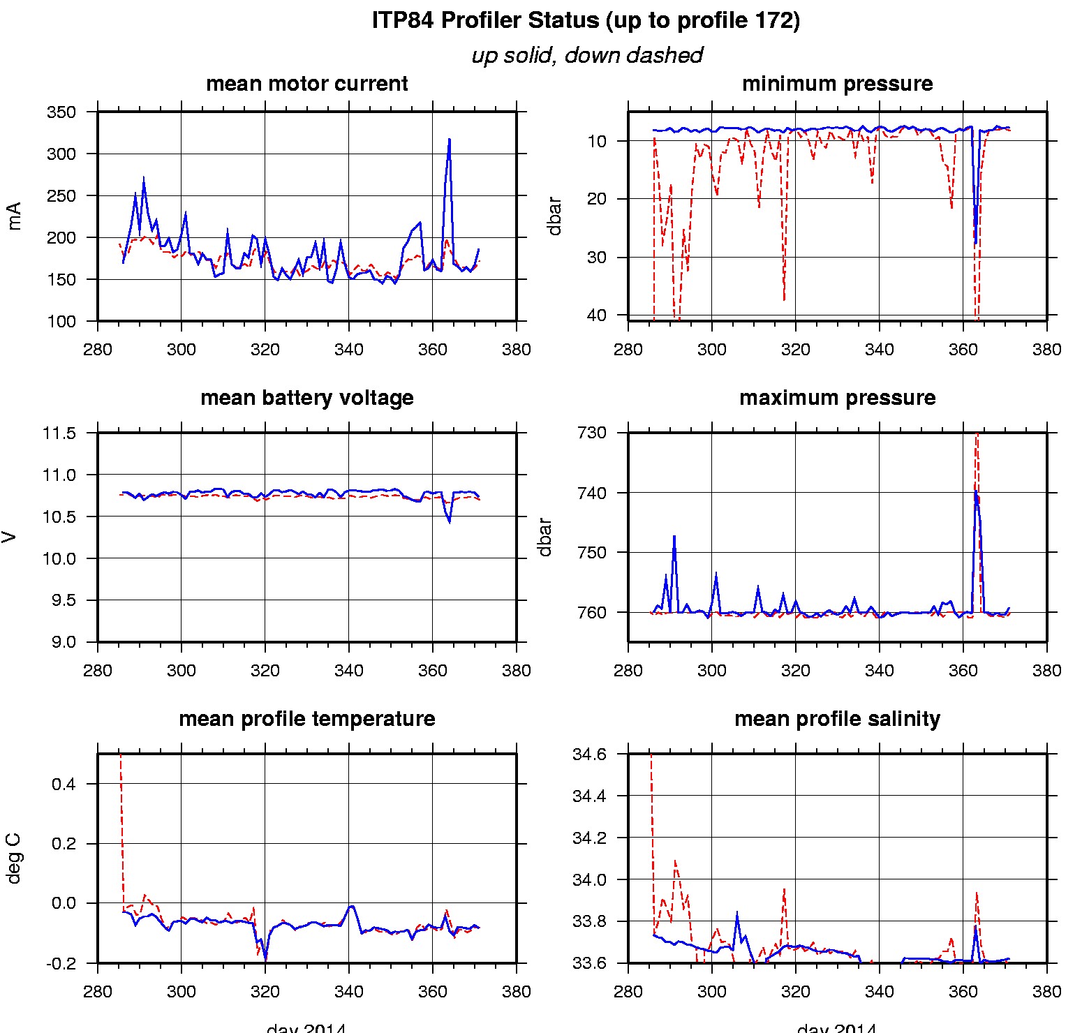
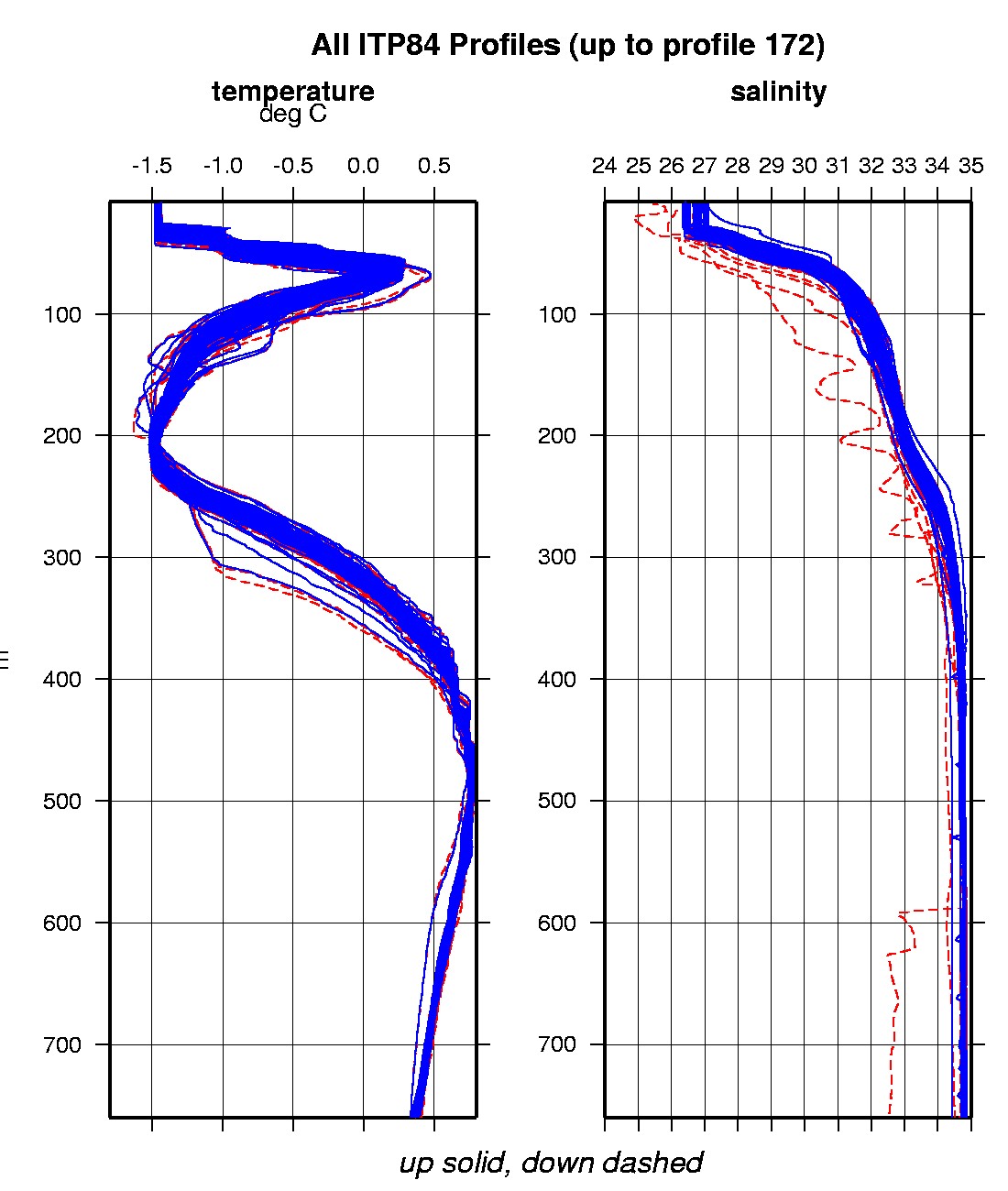
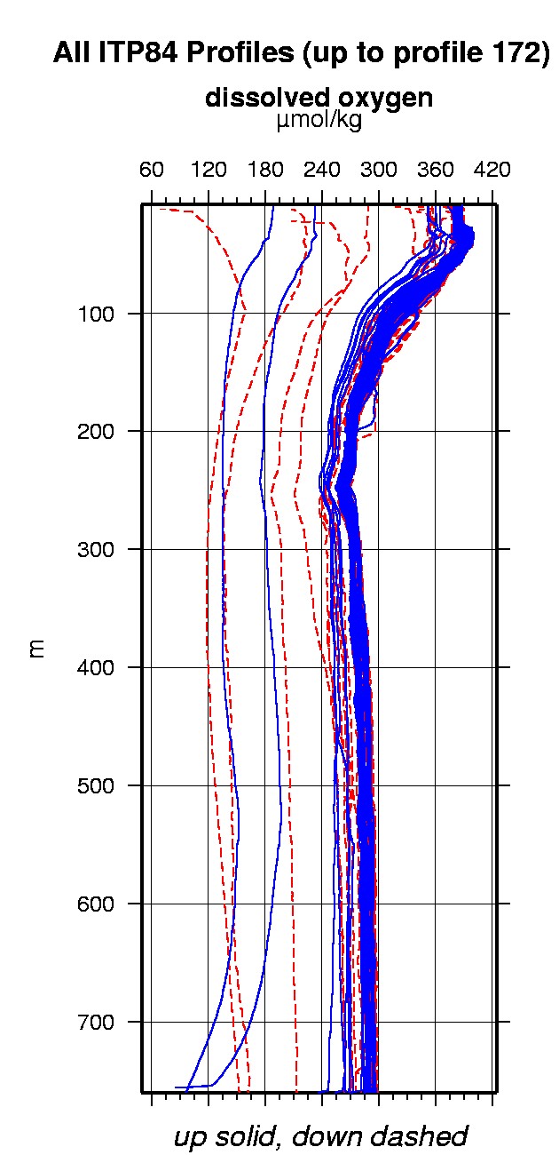
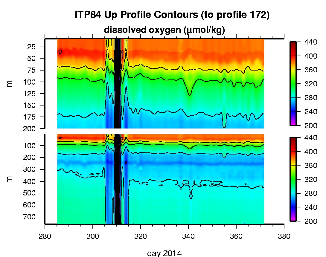
Last buoy status on 2015/8/26 32 UTC : temperature = 0 °C, battery = 11.437 V Last position on 2015/8/26 16 UTC : 77.6569° N, 163.1928° W Last profile (number 172) on 2015/1/6 602 UTC Last profile mean motor current = 172.3019 mA, mean battery = 10.6993 V Last profile depth: minimum = 8.2641, maximum = 760.025 m Last profile temperature: minimum = -1.4783, maximum = 0.7674 °C Last profile salinity: minimum = 27.0069, maximum = 34.8031 Last profile dissolved oxygen: minimum = 259.3985, maximum = 386.1935 μmol/kg Last Microcat sample (number 2084) on 2015/1/6 70057 UTC Last temperature = -1.4752 °C, salinity = 27.0417 Last Dissolved Oxygen = 377.0184 μmol/kg Last SAMI IMM transfer on 2015/1/6 70208 UTC Last SAMI pCO2 sample (number 1602) on 2015/1/6 60017 UTC Last pCO2 = 387.5039 μatm The raw GPS buoy location data are available in an ASCII file: itp84rawlocs.dat Depth averaged profiler data files (with interpolated location) and time series SAMI data are available in two formats: ITP84 was deployed on a 1.96 m thick ice floe in the Beaufort Sea on October 11, 2014 at 76° 1.9 N, 139° 48.7 W as part of the Beaufort Gyre Observing System (BGOS) during the JOIS 2014 cruise on the CCGS Louis S. St. Laurent. On the same icefloe, a US Army Cold Regions Research and Engineering Laboratory (CRREL) Seasonal Ice Mass Balance Buoy and an autonomous atmospheric chemistry buoy (O-Buoy) were also installed. The ITP includes a dissolved oxygen sensor and is operating on a standard sampling schedule of 2 one-way profiles between 7 and 760 m depth each day and includes a fixed SAMI PCO2 and SBE-37 microcat at 6 m depth.
|