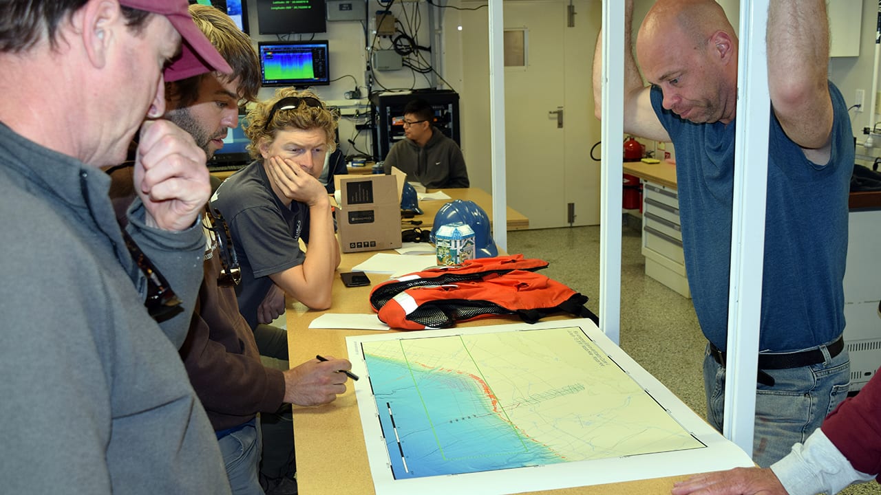
Scientists aboard the research vessel Neil Armstrong study a map of coastal New England to plan a multichannel seismic survey of the continental shelf and slope. The survey provides data describing rock outcrops along the edge and slope of the continental shelf, which is key to understanding the stability of the slope and the potential for submarine landslides. On this voyage, researchers also searched for large reservoirs of fresh water trapped beneath the seafloor. The researchers are: (from left) Chuck Worley and Nathan Miller from the U.S. Geological Survey and Jim Eisenbeck and Rob Evans (standing) from WHOI. (Photo by Evan Lubofsky)
More Content From :
How the Ocean Works

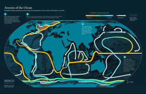
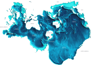
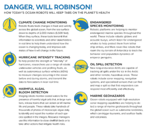

Image and Visual Licensing
WHOI copyright digital assets (stills and video) on this website can be licensed for non-commercial use upon request and approval. Please submit your request via our Media Request Form.
For assistance or accessibility accommodations, call (508) 289-2647.