Each spring, the melting ice sheet forms large lakes. A decade ago, scientists discovered that cracks can form suddenly in the bottom of these lakes and drain them within hours. To learn how this phenomenon happens, a research team led by Sarah Das (left) and Mark Behn at WHOI and Ian Joughin at the University of Washington (center), along with UW graduate student Josh Carmichael (right), installed a network of GPS units to record the movements of the ice before, during, and after a sudden drainage event. Their study, published in June 2015, discovered a surprising trigger mechanism. (Photo by Laura Stevens, Woods Hole Oceanographic Institution)
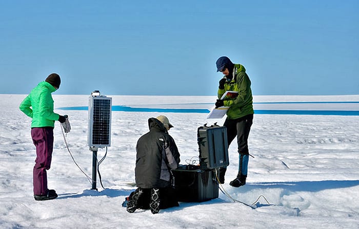
Image and Visual Licensing
WHOI copyright digital assets (stills and video) contained on this website can be licensed for non-commercial use upon request and approval. Please contact WHOI Digital Assets at images@whoi.edu or (508) 289-2647.