From a helicopter, deep meltwater channels on Greenland’s massive ice sheet become visible. Lakes form on the ice each summer as the sun returns. As lakes fill, the channels overflow and become hidden from view when standing on land. Only through an aerial survey can you see features like this in detail. By coordinating GPS positions with digital photographs, researchers can precisely map the locations of these lakes, which they are studying to learn about climate change. They also compare their observations with satellite images.
(Photo by Chris Linder, Woods Hole Oceanographic Institution)
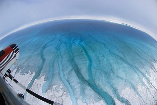
Image and Visual Licensing
WHOI copyright digital assets (stills and video) on this website can be licensed for non-commercial use upon request and approval. Please submit your request via our Media Request Form.
For assistance or accessibility accommodations, call (508) 289-2647.