A Buoy’s Long Strange Trip
An oceanographic instrument drifts from the Arctic to Ireland
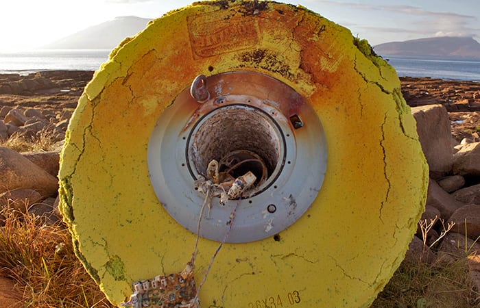
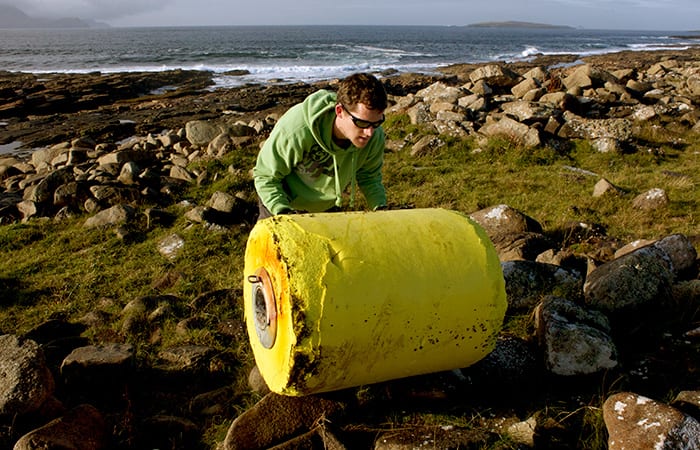
Western Ireland is cool and rainy in late September—good weather for ducks. Irish filmmaker Fergus Sweeney was walking along Blacksod Bay, County Mayo, last fall, when he saw a big round object washed ashore in the distance. It was bright yellow, the color of a rubber duck, but nearly as a big as a bathtub.
Sweeney took a closer look and saw that it was an oceanographic buoy. But where had it come from, what was it for, and what brought it to Ireland?
Sweeney began digging for information starting with faint markings on the buoy. The trail led up to the North Pole, where the buoy was set into Arctic sea ice in 2011. And it spanned the Atlantic to Woods Hole Oceanographic Institution (WHOI), where oceanographer John Toole and WHOI engineers have built a series of specialized buoys to measure ocean conditions in the remote and fast-changing Arctic.
Arctic wanderers
“By the time the buoy washed ashore, the only visible marking was an embossed name of the flotation foam manufacturer, Gilman Corporation,” Toole said. Sweeney opened an access panel, found a GPS module, and took photos for identification.
“Fergus contacted [company owner Elizabeth] Gilman; Gilman contacted WHOI, and we eventually sorted out that it was one of our ITPs,” Toole said.
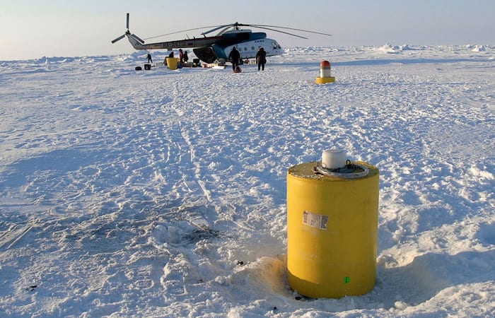
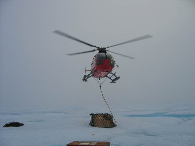
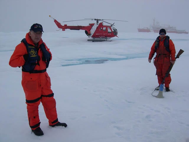
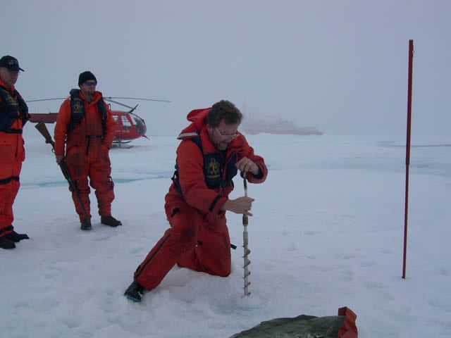
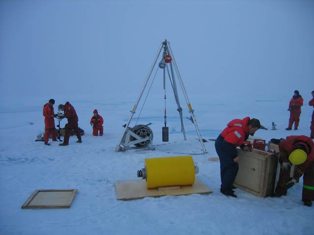
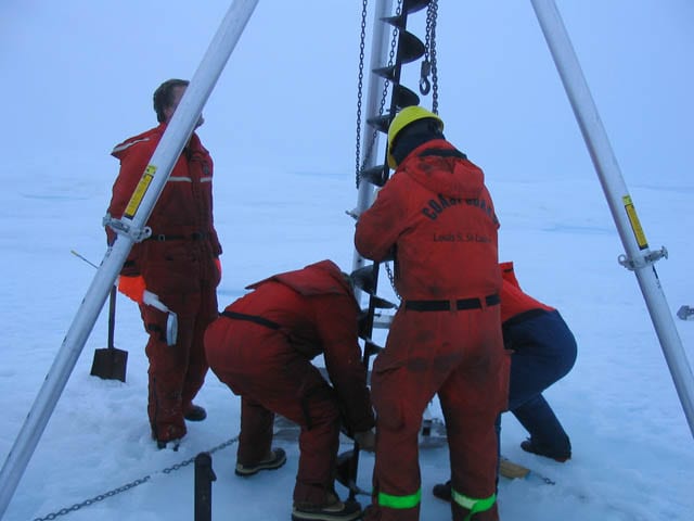
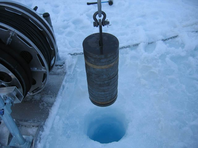
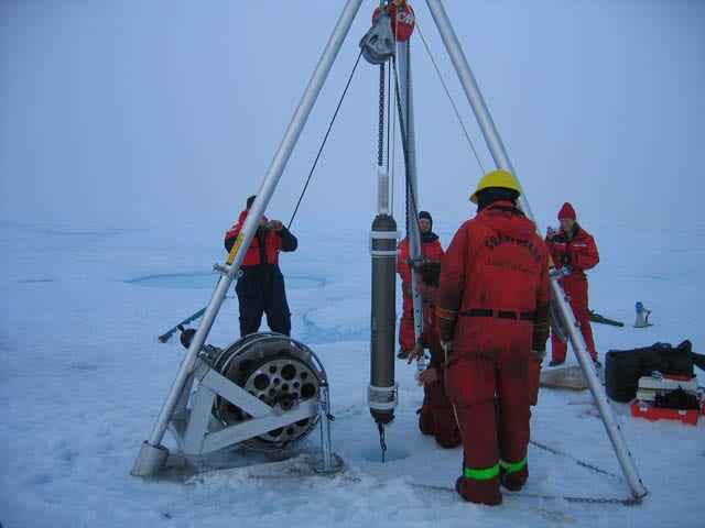
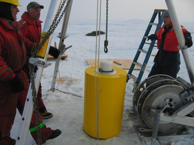
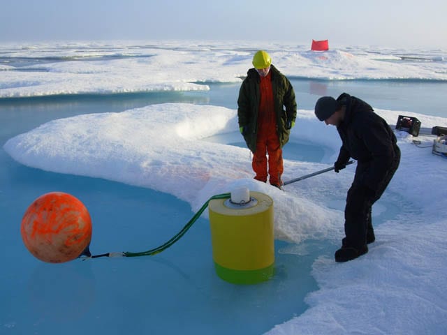
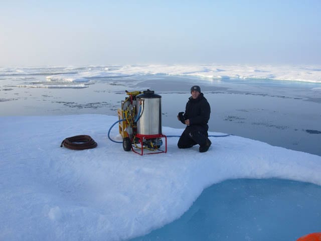
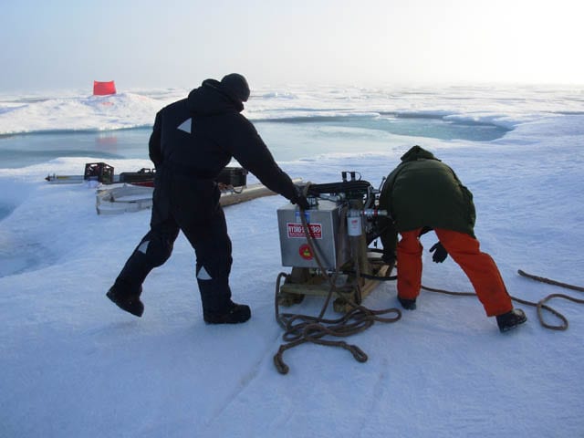
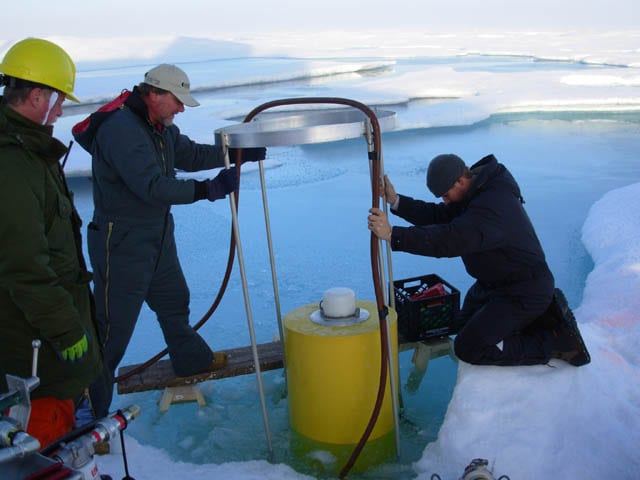
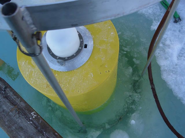
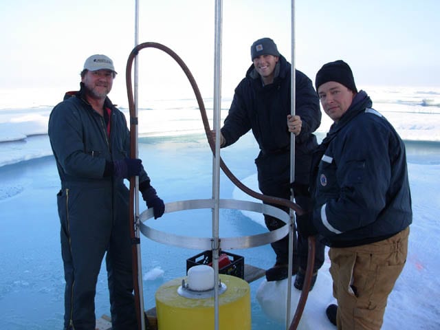
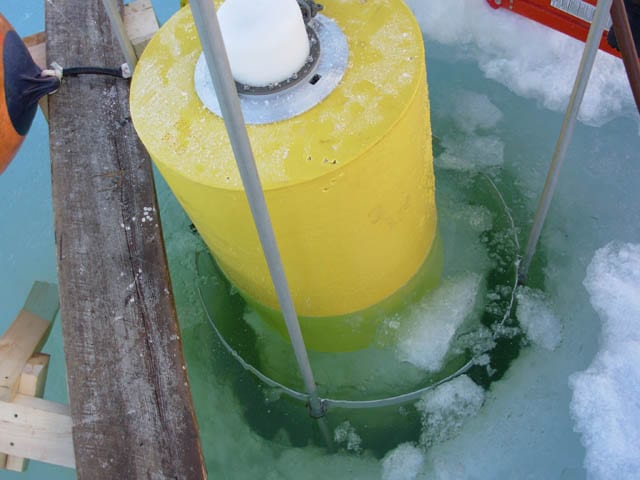
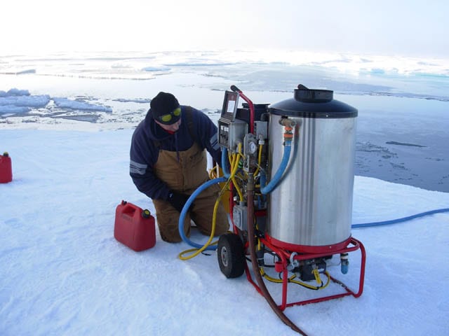
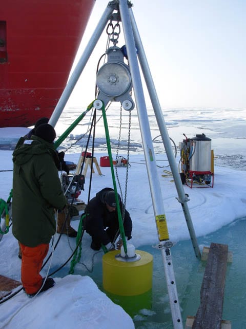
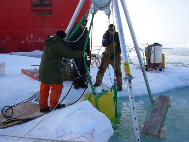
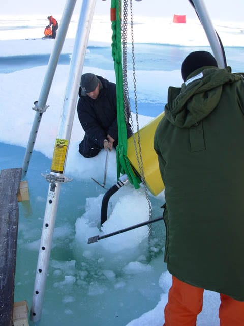
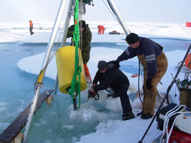
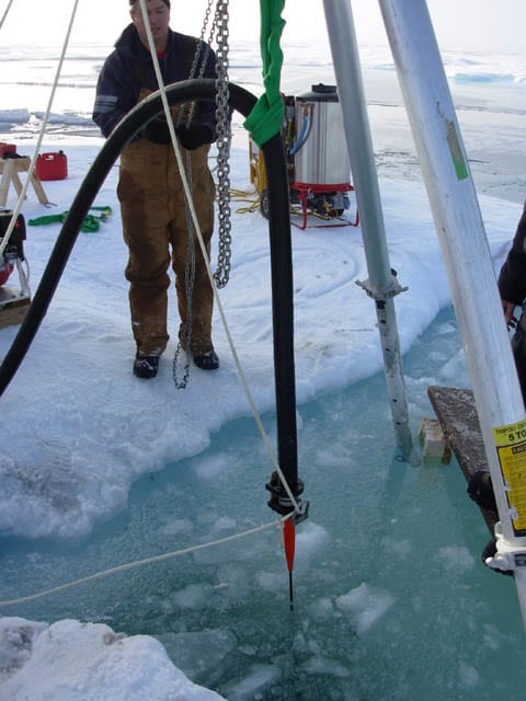
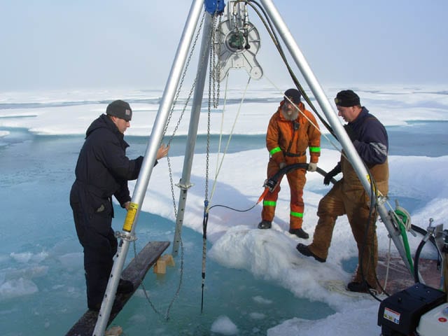
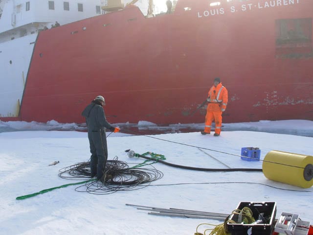
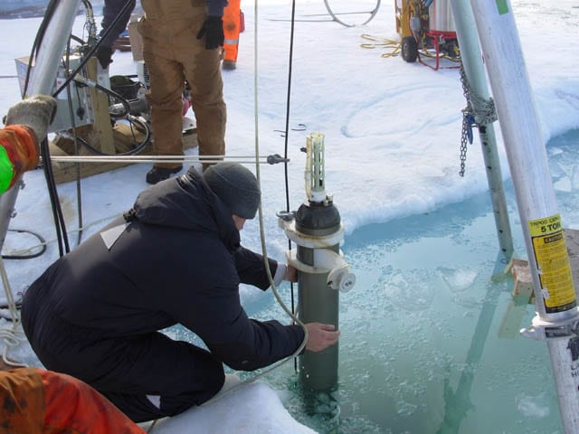
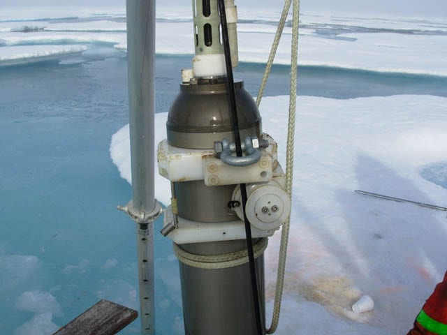
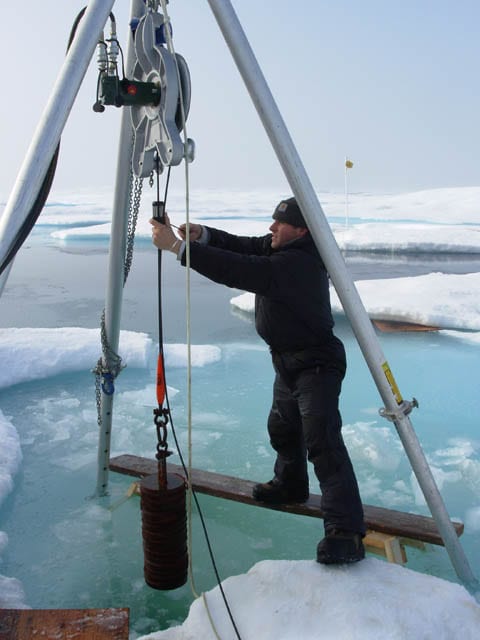
ITP stands for Ice-Tethered Profiler. These expendable robotic devices are deployed through holes drilled in Arctic sea ice. The buoys on the ice support long weighted lines hanging beneath. A motorized “profiler” unit crawls up and down the line, measuring water salinity and temperature from just beneath the ice to hundreds of meters down, as the ITP rides along with the drifting ice. Electronics in the buoy transmit the data and locations to shore via satellite.
Since 2004, WHOI scientists have deployed more than 60 ITPs to reveal changes in sea ice, seawater properties, ocean currents, and other conditions in the Arctic, even in the frigid, dark winter. They are illuminating a critical blind spot—a region that is difficult to monitor and highly vulnerable to climate change.
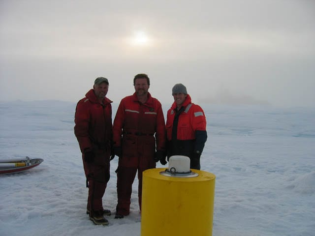
Sweeney had many email conversations with Toole and WHOI engineers Rick Krishfield, Steve Lambert, and Kris Newhall. They were able to identify the washed-ashore buoy and re-create its history. As a picture of the buoy’s journey emerged, Sweeney began to conceive of an educational exhibit about the buoy at the local arts center.
This buoy’s life
Most ITPs don’t have long lives—about two years at most. They collect and send data until their batteries fail, their tether lines snag on the bottom and break, their underwater units are stripped off the line, or ice crushes them. This one, identified as ITP 47, was exceptionally long-lived.
“This particular buoy had been used on a previous ITP deployment, recovered, then reused as ITP 47,” Toole said. That caused some confusion when trying to work out what had happened.
In October 2009, ITP 35 was deployed on an ice floe in the Beaufort Sea. It drifted clockwise with the ice, collecting data to 2,500 feet (760 meters) deep, until October 2010, when it was recovered on a return expedition. In April 2011, back it went into ice near the North Pole, this time as ITP 47.
It drifted south and collected and sent data until Dec. 24, 2011, when transmissions ceased. The scientists think that colliding sea ice rode up and over the floe that ITP 47 was on, and buried the buoy.
“At its last transmission, ITP 47 was just north of the northern tip of Greenland,” Toole said. But months later, in May 2012, the buoy started transmitting again. “It was milling about west of Iceland.”
Most of that time the profiler had been doing its job, collecting data. But stuck beneath the ice, it couldn’t relay them.
“It was pushed under the ice and couldn’t get a satellite signal to call home for quite a while,” Lambert said. “Then it popped up between Greenland and Iceland.”
“Once the buoy could again see the sky, it transmitted to us its backlog of profile data, collected between Dec. 24, 2011, and Feb. 28, 2012,” Toole said. The underwater unit stopped recording data then, probably because it was damaged by being dragged on the seafloor.
The surface buoy continued to report its position until early October, when, in hindsight, Toole said, the electronics housing leaked and the instrument stopped working. As for what happened next, Toole could only make an educated guess that ITP 47 was blown eastward by the wind, against prevailing westerly ocean currents, to Blacksod Bay.
Ambassador for ocean science
Arctic ITP buoys have washed up before—in Iceland, Scotland, the Orkney Islands, and Svalbard, Norway. This isn’t unexpected, given an ITP’s lifestyle, but it’s still surprising to anyone who finds one on a beach, as Sweeney did. (Even as recently as Feb. 7, 2014, WHOI received an email from Aodh O’Donnell, director of a furniture company in Skibberen, Ireland, who wrote: “Good Morning. It looks like I have one of your buoys! I found it in West Cork Ireland!”) If undamaged, WHOI investigators arrange for the return of the ITP components, so they may be reused. But after two deployments ITP 35/47 was in bad shape and no longer useful for science.
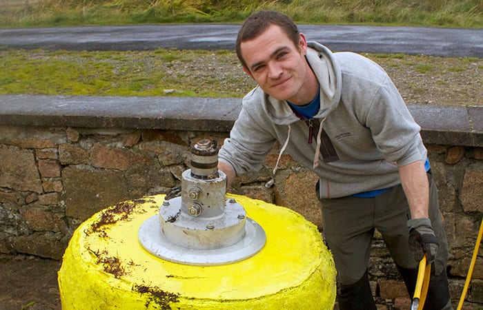
ITP 47 had already had two lives, but Sweeney made sure it lived on. He retrieved the buoy, created a Facebook page and YouTube video, and worked with local students on an educational exhibit called “Drifted, ITP 47.” It showcases the buoy and its electronics and includes multimedia presentations about ITP 47’s path, WHOI scientists, climate research, and wildlife the buoy may have encountered. The exhibit was shown at Áras Inis Gluaire in Belmullet, Ireland.
“All this work in the exhibit was done by people from Erris,” Sweeney said, referring to the local area. “What Steven, John, and their colleagues do allows us to follow what’s happening in the world’s ocean. Just as we need photographers and people to do art exhibitions, we need researchers and scientists to tell us what’s happening in our planet. I think more people will appreciate their work now.
“The world’s climate is changing, and they are telling us. These types of people inspire people like me, so when I see something washed up on the beach, I say, ‘Maybe I could do something with that.’ “
The ITP program has been supported by the National Science Foundation, WHOI, and several European research programs. “Drifted: the story of ITP 47” was supported by Brendan Murray, artistic director of Áras Inis Gluaire Art Center.
Another Lost Buoy—ITP 6
When Aodh O’Donnell discovered the surface buoy of an Ice Tethered Profiler (ITP) in Cork, Ireland in February, it was the second ITP buoy to come ashore in Ireland. Like ITP 47, this second buoy’s identifying marks had also been largely obliterated during its drift. O’Donnell contacted WHOI, and with instructions from Senior Research Specialist Rick Krishfield, he opened the buoy’s electronics housing and extracted labeled components that identified the system as ITP 6, one of the earliest ITPs launched.
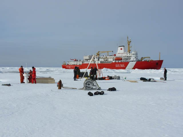
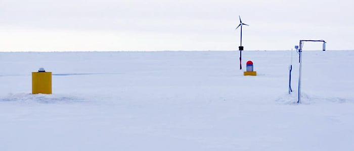
In September 2006 the WHOI ITP group deployed ITP 6, see at left in the photo by Rick Krishfield—along with (center) an Arctic Ocean Flux Buoy that measured heat transfer and (right) an Ice Mass Buoy that monitors ice thickness—on a 9 foot-thick ice floe in the central Canada Basin northeast of Alaska. ITP 6 drifted clockwise with the Beaufort Sea Gyre for more than a year before being carried out of the gyre to the northeast and into the Arctic Ocean.
Summer 2007 saw a dramatic retreat of the Arctic sea ice cover, and the ice floe supporting ITP 6 thinned by melting from more than 9 feet thick to only about 20 inches. We think the heat that caused this melting came from solar warming of the open-ocean waters between ice floes in the regions ITP 6 traversed. Due to the melting, ITP 6’s surface buoy likely sank deeply into its ice floe, leaving little freeboard. Ridges forming in the ice covered the buoy and blocked satellite data telemetry—for 2 months in late 2007 and for 8 months in 2008—but even while buried, the ITP continued to operate, measuring water properties, and logging the data internally. When the surface buoy resurfaced each time, it sent the stored data back via satellite.
The profiler ceased operating in July 2008 when its internal battery supply was exhausted. Over its lifetime, ITP 6 collected 1,335 vertical profiles of temperature, salinity and dissolved oxygen. Communication from ITP 6’s surface package ceased for good in October 2009, when the instrument was about 100 miles north of Ellsmere Island, over the continental slope. Presumably currents and wind carried the buoy south and eventually east, to the west coast of Ireland on a track similar to ITP 47’s drift. But the details of that four-year-plus journey after we lost contact with the buoy remain a mystery.
Slideshow