Meet the ChemYak!
WHOI scientist Anna Michel discusses our new ocean surface robot
 This article printed in Oceanus Fall 2019
Estimated reading time: 3 minutes
WHOI Scientist Anna Michel is an ocean engineer who creates tools and platforms to study ocean chemistry in areas impacted by climate change. For the past two years she has been using a new surface robot called the ChemYak. The ChemYak is based on the Woods Hole Oceanographic Institution’s original JetYak (designed and built by Peter Traykovski, Hanu Singh, and Kevin Manganini) but Anna Michel and her colleague David (Roo) Nicholson modified it to enable new types of measurements that they need for their work.
What is the ChemYak?
The ChemYak looks like a kayak but has an engine and is outfitted with chemical sensors so we can take measurements of surface waters.
What are you sensing?
Methane, carbon dioxide, nitrate, and oxygen.
Methane and carbon dioxide are greenhouse gasses so we are interested in how much is being emitted in environments that are hard to make measurements in. The ChemYak can go into really shallow salt marshes or unstable places near sea-ice in the Arctic. It allows us to bring sensors into these difficult environments.
The ChemYak also has CTD sensor suite to measure conductivity, temperature, and depth. We have a winch on it so we can actually lower it down into the water and measure the methane and carbon dioxide through that profiling system too.
How did you get samples before you had the ChemYak?
When we go out to take measurements in a location we usually grab a water sample and bring it back to the ship or the lab to analyze it. If we only take a few measurements, that’s a limited representation of what’s going on in the environment.
The ChemYak allows us to take measurements over the course of a whole day. Usually we go back to the same place repeatedly over the course of a week. By taking measurements over time we can get a much better understanding of how the environment is changing. There are lots of instruments to analyze a sample once you have it, but few platforms like the ChemYak that allow you to take instruments out into the field with you.
Where have you taken the ChemYak?
We did a deployment in the North River, which is south of Boston. We drove the ChemYak up the river to look at what was happening in the water body. Because the ChemYak is small it can go into side channels that we can’t get into with most boats.
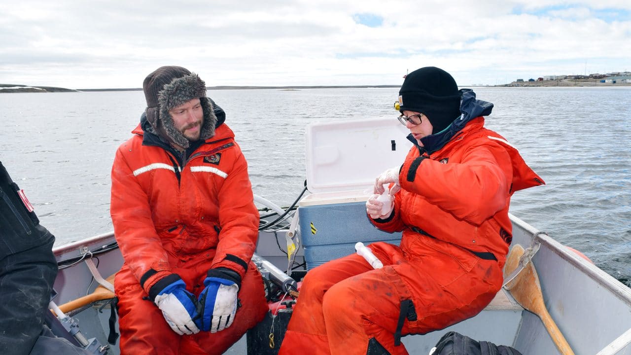
We also did a deployment in the summer of 2018 in Cambridge Bay in the Arctic. We had the ChemYak do a survey as the ice broke up in a river in that area. We see a lot of methane released when the ice breaks up so we want to know how to capture that in time. When does it actually release the methane? How much is coming out?
Why is it important to track the release of methane?
As a greenhouse gas, the more methane that is released, the warmer temperatures we get. With warmer temperatures, more methane will be released. It’s a feedback loop. If there is a big spike in methane released in the Arctic when the ice breaks up, but we aren’t there that day, we wouldn’t see it and we might underestimate how much has been released into the environment.
How are you processing all that data?
We are working with collaborators at the University of British Columbia to use the Cambridge Bay data. They have samples they’ve taken over several years at these sites but they sometimes have just one sample per week and so we are coupling our data with theirs to try to understand what is actually happening with the methane in this environment. And we will hopefully go back again and make some more measurements.
The North River data showed distinct differences in small side channels from the main river. This suggests that using the ChemYak in these environments can provide us with data we otherwise may not get.
How can the ChemYak impact the field ocean chemistry?
The sensors on the ChemYak are expensive, but the boat itself is not. As engineers, we are trying to move sensors towards being lower cost and smaller so more scientists can take measurements over larger areas of the coastal ocean – and areas that are often difficult to access by boat.
MEET THE AUTHOR Hannah Piecuch
Hannah Piecuch is a staff writer for Oceanus magazine and a designer in WHOI’s Creative Studio. As both a writer and designer, she has a comprehensive...
Read more