Float 312, Where Are You?
In one week, people found two rarely seen ocean instruments
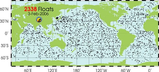
The ocean is so enormous, even a fleet of 2,338 ocean-monitoring instruments can sail into it and go largely unnoticed. That’s what floats 312 and 393 were doing until something extraordinary happened: People found them.
“To have folks stumble on these two in one week is a real surprise,” said Jim Valdes, an engineer at Woods Hole Oceanographic Institution who designs and builds floats.
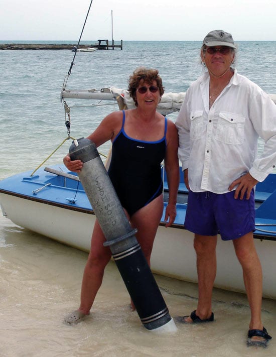
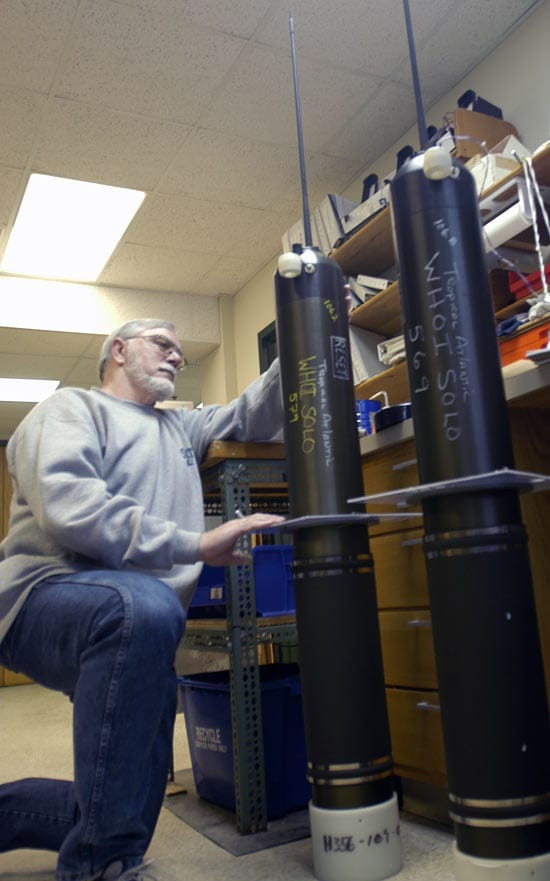
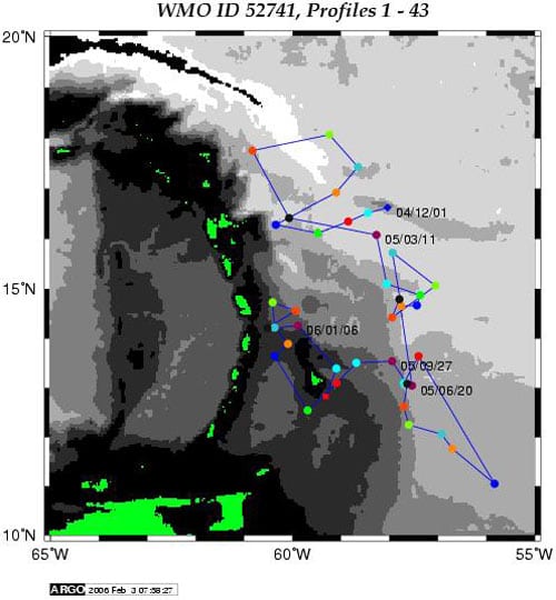
During the past six years, scientists have been releasing 5-foot-long, torpedo-shaped floats throughout the ocean—part of an international program called Argo. The instruments mostly drift at depths of 5,900 feet (1,800 meters). Once a week or so, they poke their skinny black antennas above the surface for about 12 hours to transmit temperature and salinity data to shore via satellite and then submerge again.
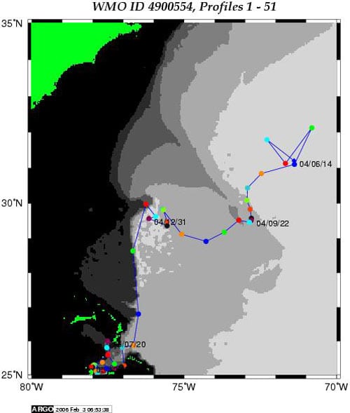
Valdes estimates that fewer than three floats a year go missing. Then, this winter, float 312 beached in the Bahamas, after traveling more than 1,000 nautical miles (1,850 kilometers) since its launch east of central Florida in June 2004. Float 393 ended up aboard a fishing boat off Barbados.
Valdes has subsequently pieced together their journeys. Before launch, every float is tagged for monitoring via satellite, so scientists do see where they are and where they shouldn’t be. Float 312, for example, began to concern physical oceanographer Breck Owens in late January. He saw on his computer screen at WHOI that it was making a beeline to land, likely tossed by currents into shallow water and then spit onto shore.
“I was pretty sure that it was going to be a loss,” Owens said. Then he received a surprise e-mail on Jan. 18 from a Canadian tourist who noticed the marooned float while snorkeling east of Andros Island.
She traced the float to WHOI’s Ocean Instruments website. Assured that it wasn’t dangerous, the tourist, Christine Yeomans of British Columbia, returned with a motorboat to collect the 80-pound instrument.
“My husband and I swam it back to the boat (no mean feat)!!!” Yeomans wrote in an e-mail. “Then he and our Bahamian guide pulled it into the boat. My husband unfortunately cracked his rib in the process. So we are hoping that this recovery will be somewhat useful and ‘not for naught.’ ”
Yeomans sent Valdes photos, which showed that float 312’s O-ring seal was compromised and had let seawater inside its pressure case. It was a goner. Valdes contacted a U.S. Navy acoustic test facility on Andros Island, which retrieved the instrument to dispose of it properly.
Float 393 had a happier fate. It was picked up 29 miles south of Barbados on Jan. 25 by a fisherman, Erwin Clark Breedyland. He made inquiries that eventually led back to Valdes.
Onshore, float 393 continued to transmit data, suggesting that it was intact and functioning, Valdes said. “I made arrangements for Breedyland to deploy the float 150 to 200 miles off Barbados on his next fishing trip.”
The research is funded by the Cooperative Institute for Climate and Ocean Research, a joint institute of Woods Hole Oceanographic Institution and the National Oceanic and Atmospheric Administration.
Slideshow