|
History
Russian Northern Expeditions (18th-19th centuries)
Before he died, Czar Peter the Great
sent a Dane named Vitus Bering to search for a route to America
from Kamchatka. Bering reached Cape Dezhnev in 1728, established
that a passage existed, and turned back on being alarmed by
the cruelty of the local Chukchi tribes. In 1732, the Russian
Admiralty ordered investigations of Siberia and a route to America
and Japan, consisting of three parties: a marine expedition
to the North Pacific, a land expedition to East Siberia, and
a sea expedition to map and describe the northern coast of Siberia,
later called the Great Northern Expeditions. Empress Anna put
Bering in charge of the five Great Northern Expeditions, which
lasted from 1733 to 1742.
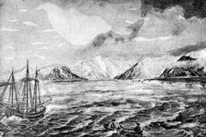
During the expeditions, thousands of kilometers of the coast
from the White Sea to Anadyr were mapped for the first time,
numerous bays, gulfs, capes and islands were discovered, and
extensive geographical material was collected. Many geographical
features are named after the Naval officers who led the explorations,
such as Cape Cheluskin, Malygin Strait, Cape Ovtsyn, Cape Skuratov,
and Cape Steligov. For instance, young naval officers and brothers,
Khariton and Dmitry Laptev separately explored the coasts east
and west of the Lena River, in what is now called the Laptev
Sea. In 1732, the western coast of Bering Strait was documented
and mapped for the first time, while the American coast was
explored by Bering and Chirikov in 1741.
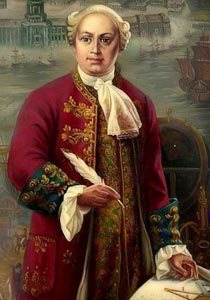
The eminent Russian physicist and philospher, Mikhail Lomonosov,
participated in the Great Northern Expeditions for 20 years.
He organized specialized polar explorations, supplying each
vessel with physical and astronomical instruments, teaching
navigators to make physical measurements, and developing specialized
ship logs and meteorological log books. In 1763, he wrote a
remarkable description of explorations in the northern seas
from the time of the Russian Pomors to the expeditions, and
included a discussion of Arctic oceanography. He suggested a
scheme of currents in the Arctic Ocean, described ice drift
mechanics, classified sea ice types, and considered the dependence
of the freezing point of seawater on salinity. He explained
the role of the sun as a source of heat in the Arctic, postulated
that heat exchange from the sea to the air through the ice cover
moderated Arctic climate, and also gave the first scientifically-based
theory of the aurora (northern lights). On the Arctic
map attached to the book, Lomonosov portrayed ocean around
the North Pole, contrary to generally accepted opinion.
Inspired by Lomonosov's theories, Vasily Chichagov led an expedition
to navigate across the Arctic Ocean to Bering Strait from Spitsbergen
in May 1765, but the way was blocked with heavy ice. Meanwhile,
Fedor Rozmyslov was sent to look for a Northeast Passage via
Novaya Zemlya. At the end of summer 1768, Rozmyslov reached
Matochkin Shar after a difficult voyage and entered the Kara
Sea but could not proceed because of a problem with the ship.
After wintering on Novaya Zemlya, and unsuccessful attempts
to repair the ship, the survivors returned to Arkhangelsk in
a merchant boat. Meanwhile, other remarkable Russian explorers
were wintering over on Spitsbergen and on the southern island
of the Novaya Zemlya archipelago, which was also being circumnavigated
for the first time. Farther east, Nikita Shalaurov sailed from
the Lena River hoping to discover new islands and the full passage
to the Pacific Ocean, but ended up mapping the Arctic coast
from Lena estuary to Shelagsky Cape. In 1785, an attempt to
sail through the Northern Sea Route was made from Kolyma to
the east by Iosif Billings and Gavriil Sychev, lasting 8 years.
Also in the 1760s, the Alaskan coast of North America was being
visited by the Russian explorers Krenitsin and Levashev, but
it wasn't until the 1780s that the first Russian settlements
on the American continent were founded. In 1784 a merchant adventurer,
Grigory Shelikhov, established a village on Kadyak Island and
wrote a book proposing permanent Russian settlements in North
America. In 1798-99, Shelikhov's successor Alexander Baranov
founded a town called New Arkhangelsk on Sitkha Island (presently
Baranov Island), which became the capital of Russian America.
By the first quarter of 19th century, there were 12 large Russian
settlements in different corners of Alaska, which were administered
by the Russian-American Company until Alaska was sold to the
US in 1867.
After the Napoleonic Wars, the Russian Admiralty renewed interest
in describing the many "white spots" on the maps of the polar
regions. Consequently, in 1819 two expeditions were sent to
either ends of the globe. During the next 4 years, the Far Northern
expedition made a number of discoveries in the North Pacific,
described the coast of the North America, passed through Bering
Strait, and went farther northward than all previous expeditions.
Meanwhile, Feodor Litke thoroughly mapped the west coast of
Novaya Zemlya in 1821-1824 and carried out geographical and
hydrographical investigations. In another expedition between
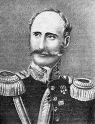
1821 and 1824, Feodor Wrangel and F. Matyushkin described hundreds
of miles of Siberian coast, and discovered Bear and Wrangel
Islands. Based on his own experience, Wrangel suggested that
the North Pole could be reached using sledges over the Arctic
sea ice. P. Pakhtusov voyaged twice to Novaya Zemlya between
1832 and 1835, wintered on the island, obtained detailed meteorological
observations, and described southern and eastern parts of the
archipelago. About the same time Russian Naval officers produced
the first realistic map of the New-Siberian Islands and Siberian
coast from Olenek to Indigirka River.
Reference:
Imbert, B., North Pole, South Pole: Journeys to the Ends
of the Earth, Harry N. Abrams, Publishers, New York, 192
pp., 1992.
 Previous Chapter
Next Chapter Previous Chapter
Next Chapter

|