
Image
You Can’t Get This Map at AAA
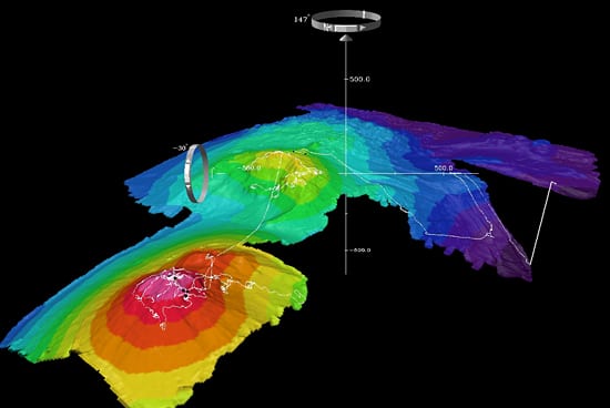
June 15, 2007The Autonomous Benthic Explorer (ABE) used sonar signals to compile this bathymetric map (the underwater equivalent of topography) of the Susu Knolls area off the coast of Papua New Guinea. This particular view also shows path of the remotely operated vehicle Jason, which took close up pictures and samples after ABE finished mapping. (Rendering courtesy of Dana Yoerger, Woods Hole Oceanographic Institution, and Vicki Ferrini, Lamont Doherty Earth Observatory)
Image and Visual Licensing
WHOI copyright digital assets (stills and video) contained on this website can be licensed for non-commercial use upon request and approval. Please contact WHOI Digital Assets at images@whoi.edu or (508) 289-2647.