
Infographic showing June 2011 Cesium-134 levels in the Pacific
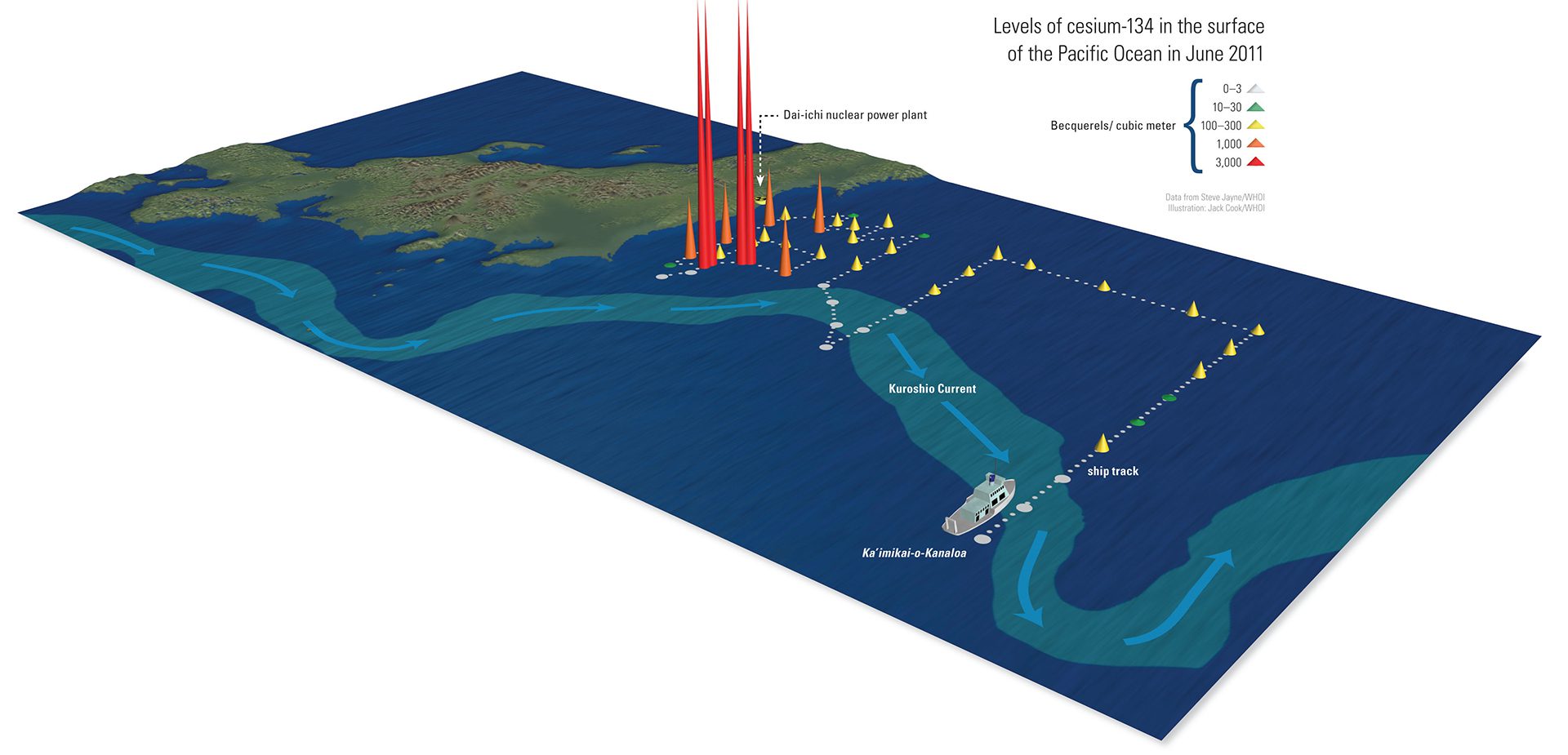
Starting 375 miles off Japan, researchers on the Kaimikai o-Kanaloa measured radioisotope levels in various locations. They found that the Kuroshio Current blocked the southward flow of radioisotopes. Highest levels concentrated south of Fukushima, where currents trapped contamination in a swirling eddy. (Illustration by Jack Cook, © Woods Hole Oceanographic Institution)
Image and Visual Licensing
WHOI copyright digital assets (stills and video) contained on this website can be licensed for non-commercial use upon request and approval. Please contact WHOI Digital Assets at images@whoi.edu or (508) 289-2647.