
Visualization of the Polar Jet Stream
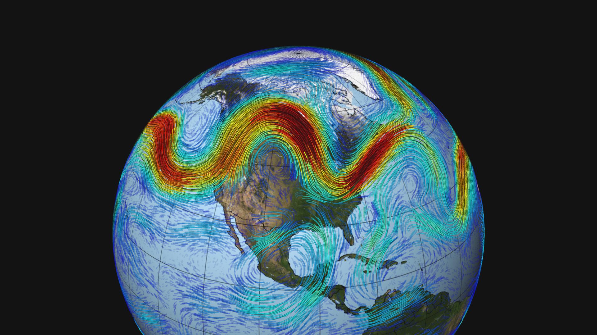
The polar jet stream, depicted above, is a fast-moving belt of westerly winds that traverses the lower layers of the atmosphere. The jet is created by the convergence of cold air masses descending from the Arctic and rising warm air from the tropics. It’s strongest during the winter when the temperature
difference between warm and cold air in the Northern Hemisphere is at its highest. (NASA Scientific Visualization Studio, © National Aeronautics and Space Administration)
Image and Visual Licensing
WHOI copyright digital assets (stills and video) contained on this website can be licensed for non-commercial use upon request and approval. Please contact WHOI Digital Assets at images@whoi.edu or (508) 289-2647.