
Image
Exploring a volcanic landscape
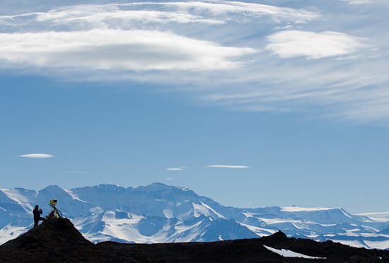
February 23, 2010WHOI scientists set up an isolated research camp in the cold Dry Valleys in Antarctica in December 2007 on a month-long expedition to explore how the volcanic landscape formed and evolved. Volcanologist Adam Soule is shown using a device called LIDAR (Light Detection and Ranging), which beams a laser in a precise swath across the landscape. Reflections from every point the laser hits provide that point’s precise location.(Photo by Chris Linder, Woods Hole Oceanographic Institution)
Image and Visual Licensing
WHOI copyright digital assets (stills and video) contained on this website can be licensed for non-commercial use upon request and approval. Please contact WHOI Digital Assets at images@whoi.edu or (508) 289-2647.