
Image
Ship Shape
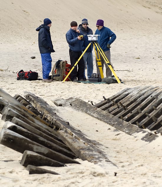
April 8, 2008WHOI researchers prepare to make a light detection and ranging (LIDAR) survey of an old shipwreck that washed up on the Cape Cod National Seashore in Wellfleet, Mass. in March 2008 Geologist Adam Soule (second from left) fixes the position of the LIDAR with a global positioning system locator while engineer Craig Johnson (far left) and geologists Rob Evans and Dan Fornari (far right) look on. Soule doesn’t usually study shipwrecks, but he took advantage of the opportunity to test and demonstrate the new gear for his colleagues and to collect three-dimensional images of the ghost ship for local archaeologists.
(Photo by Tom Kleindinst, Woods Hole Oceanographic Institution)
Image and Visual Licensing
WHOI copyright digital assets (stills and video) contained on this website can be licensed for non-commercial use upon request and approval. Please contact WHOI Digital Assets at images@whoi.edu or (508) 289-2647.