
Geology & Geophysics
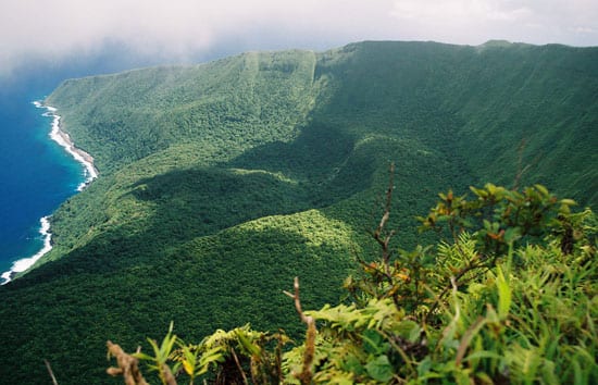
A Rare Glimpse Into the Ocean’s Crust
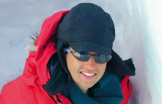
About one and a half million years ago, a great hidden piece of the ocean’s crust uplifted and rotated, giving Clare Williams a window and a time machine into Earth’s […]
Read MoreLessons from the 2004 Indian Ocean Tsunami
Woods Hole Oceanographic Institution will convene two special conferences this fall to learn from the devastating 2004 tsunami that left more than 220,000 people dead or missing. In July, another […]
Read MoreUndersea Vehicles to Study Formation of Gold and Other Precious Metals On the Pacific Ocean Floor
An international team of scientists will explore the seafloor near Papua New Guinea in the western Pacific Ocean later this month with remotely operated and autonomous underwater vehicles, investigating active […]
Read MoreNew Hybrid Deep-sea Vehicle Is Christened Nereus
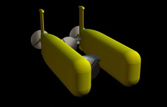
Nereus—a mythical god with a fish tail and a man’s torso—was chosen Sunday (June 25) in a nationwide contest as the name of a first-of-its-kind, deep-sea vehicle under construction at […]
Read MoreInto the ‘Mouth of Hell’
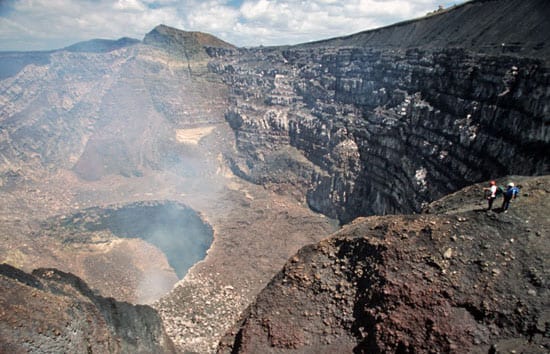
Ken Sims peers over the rim of Masaya Volcano and looks 2,000 feet (600 meters) down into the smoking crater lined with rows of jagged rocks that jut up like […]
Read MoreTo Catch an Erupting Volcano
Augustine, an island volcano 170 miles southwest of Anchorage, Alaska, began erupting in December 2005. By February, Uri ten Brink of the U.S. Geological Survey (USGS) in Woods Hole had […]
Read MoreA ‘Book’ of Ancient Sumatran Tsunamis
Exactly one year after the devastating 2004 Indian Ocean tsunami, Jian Lin found himself on a Chinese research vessel off Sumatra, floating above the epicenter of the seafloor earthquake that […]
Read MoreWorlds Apart, But United by the Oceans
Jian Lin came of age in an era of both geological and political seismic shifts in China, experiencing the deadliest earthquake in the 20th century in Tangshen in 1976 and the Cultural Revolution in the 1970s. Then he immigrated to America and came full circle in 2005 to become the first U.S. scientist to co-lead a Chinese deep-sea research cruise.
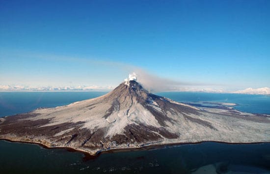
Read MoreOne of the Greatest Volcanic Shows on Earth
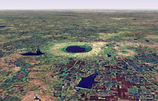
About 50,000 years ago, a huge meteorite smacked into our planet, gouging a hole more than a mile wide and 790 feet deep in India. Of the roughly 150 known […]
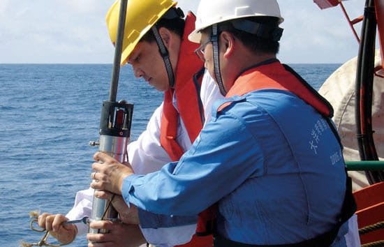
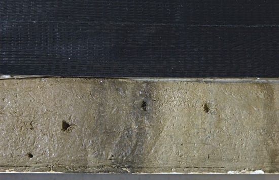
Read MoreAnalyzing Ancient Sediments at Warp Speed

Like a toy out of a science fiction story, the X-ray fluorescence core scanner reveals intimate details of the composition of ancient mud and sediment–which can contain a variety of clues about past climate and environmental conditions on Earth–without breaking the surface. In a matter of hours, the XRF simultaneously captures digital photographs and X-ray images of every millimeter of a core sample, while detecting the presence of any of 80 chemical elements.
Read MoreTracking an Ocean of Ice Atop Greenland
Sarah Das calls herself a “frozen oceanographer.” Most people look at Greenland and see a vast ice sheet covering Earth’s largest island. But Das sees a huge reservoir of water—temporarily […]
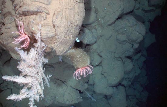
Read MoreNafanua, Eel City, and the Crater of Death
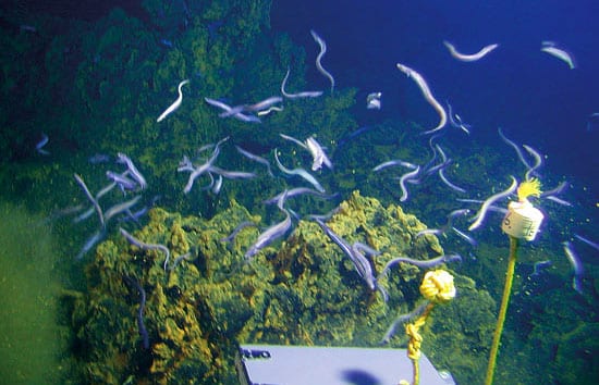
WHOI geochemist Stan Hart and colleagues have discovered a fast-growing volcano, dubbed Nafanua, inside the crater of Vailulu’u, a 14-300-foot active volcano that should begin the next island in the Samoan chain. They also found a novel hydrothermal community, which they named “Eel City,” and a lifeless zone in the caldera, which they call the “Crater of Death.”
Read MoreThe Once and Future Danube River Delta
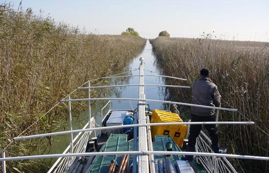
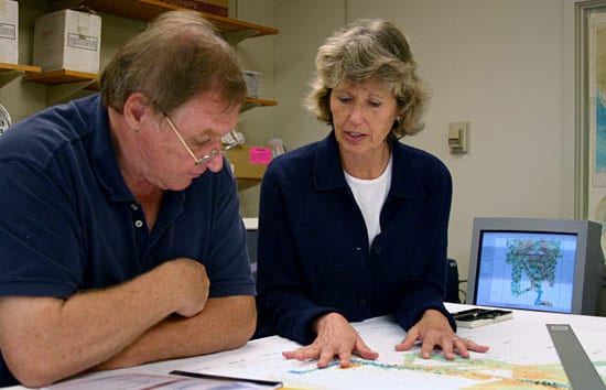
?The Danube River Delta is like the Everglades,? said Liviu Giosan, who grew up near the Romanian wetlands. The triangle-shaped, sediment-rich region at the mouth of the Danube River is also rich with human history. A traditional maritime culture persists on the delta, and the United Nations has declared the region a World Heritage site. The Danube Delta is also a great place for a geologist to study how the coast stretches, contracts, and undulates with time?and human interference.
Read MoreHart Elected to American Academy of Arts and Sciences

Senior Scientist Stanley Hart of the WHOI Geology and Geophysics Department has been elected a Fellow of the American Academy of Arts and Sciences, one of the oldest learned societies in the nation.
Read MoreOceanographic Telecommuting
‘Virtual’ chief scientist directs a research cruise without leaving land.
Read MoreRambling Atop an Active Volcano to Detect Telltale Rumbling Within It
With machete in hand and 60 pounds of satellite receiver and tripod on his back, Jeff Standish looked up into the lush tropical brush that covered the volcano, up a steep escarpment, and up again to the summit 3,000 feet above sea level. Then he turned to Rhea Workman, a graduate student in the WHOI/MIT Joint Program, and said, “We’re going up where?”
Read MoreRapid Response
The earthquakes were coming fast and frequent, as many as 50 to 70 an hour. On the morning of Sunday, Feb. 28, undersea hydrophones began detecting the most intense swarm of earthquakes to occur in the last three years along the Juan de Fuca Ridge, about 200 miles off the Pacific Northwest coast.
Read MoreMIT/WHOI Graduate Leads the World’s Tsunami Awareness Program
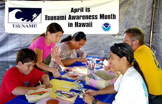
Kong, a 1990 graduate of the MIT/WHOI Joint Program in Oceanography/Applied Ocean Science and Engineering, was one of the first people in the world to learn the magnitude of the underwater earthquake off the coast of Indonesia.
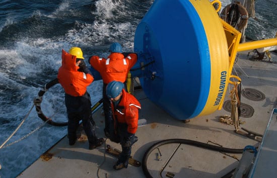
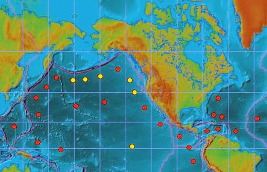
Read MoreThrowing DART Buoys into the Ocean
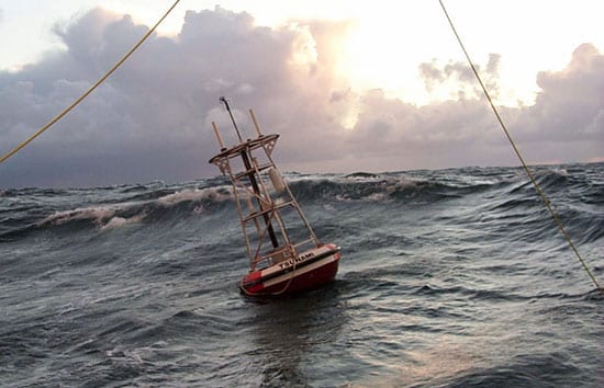
Deep Ocean Assessment and Reporting of Tsunamis (DART) buoys are the foundation of warning network
Read MoreWhat Could a Tsunami Network Look Like in the Future?
The Deep-ocean Assessment and Reporting (DART) system is battle-tested and operational, so it makes sense to use such buoys to address the immediate need for a tsunami network. Researchers at WHOI are concentrating on the next generation of multidisciplinary ocean observing platforms.
Read MoreBuilding a Tsunami Warning Network
Since the great Indonesian earthquake and tsunami of December 26, 2004, policy-makers and scientists around the globe have been embracing a rare moment of public attention on the oceans, accelerating plans to create a comprehensive tsunami-warning network and to make citizens better prepared for the next massive wave. Another potent earthquake along the same fault on March 28, 2005, has increased that sense of urgency.
Read MoreIn the Tsunami’s Wake, New Knowledge About Earthquakes
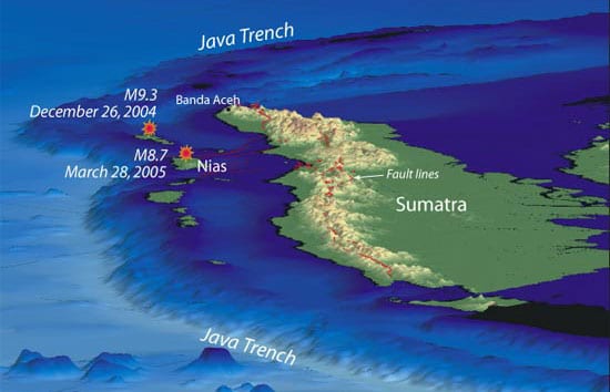
If any good has come from the recent devastating earthquakes off Sumatra, it is that they are providing scientists with unprecedented clues to understanding how these large undersea earthquakes occur and how they create tsunamis.
Read MoreTsunamis in the Caribbean? It’s Possible.
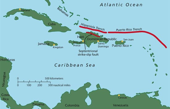
In a study published Dec. 24, 2004, in the Journal of Geophysical Research, Woods Hole geologists Uri ten Brink and Jian Lin reported a heightened earthquake risk from the Septentrional fault zone, which cuts through the highly populated Cibao valley in the Dominican Republic.
Read MoreRising Sea Levels and Moving Shorelines
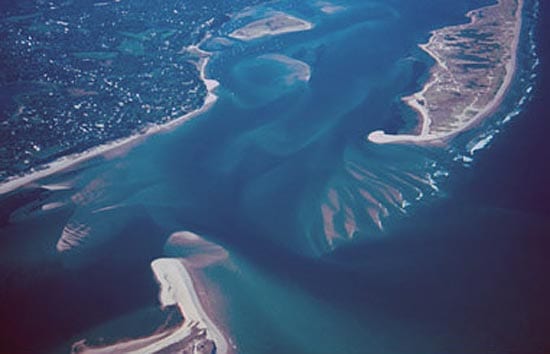
Changes to the shoreline are inevitable and inescapable. Shoals and sandbars become islands and then sandbars again. Ice sheets grow and shrink, causing sea level to fall and rise as water moves from the oceans to the ice caps and back to the oceans. Barrier islands rise from the seafloor, are chopped by inlets, and retreat toward the mainland. Even the calmest of seas are constantly moving water, sand, and mud toward and away from the shore, and establishing new shorelines.