Discovering Hydrothermal Vents
Click to enlarge »This is where a caption would go.
Click to enlarge »This is where a caption would go.
Click to enlarge »This is where a caption would go.
In this section...
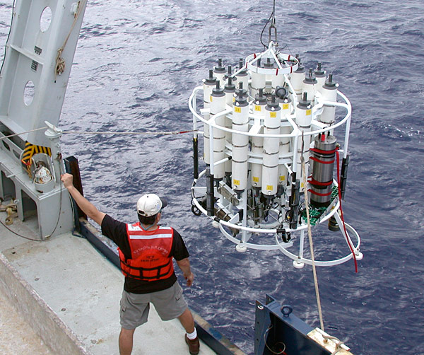
Hydrothermal plumes are areas of warm, cloudy water that rise several hundred meters above the vent sites in the middle of cold near freezing water found at the ocean bottom. Today, one of the most useful tools for detecting hydrothermal plumes is called a CTD sensor (Conductivity-Temperature-Depth). It acts like a toy “yo-yo” as it moves up and down in the water. Since the CTD is towed behind the ship, scientists nicknamed this technique a “tow-yo.” By locating the plumes with CTDs and homing-in on where they are most concentrated, scientists learned that they could increase their chances in finding vents.
Tow-yo CTD mapping was the key to finding more vents along the global mid-ocean ridge, and scientists from many countries started using this technique in the late 1980s. This technique uses the CTD system while the ship moves slowly, at about 1 knot (1 mile per hour, or the pace of a slow walk) and the CTD is raised and lowered on a conducting cable in the depth zone where the hydrothermal plumes are thought to occur—between 200-300 meters above the seafloor.
The CTD’s job is to measure the salinity and temperature, while another sensor, called a transmissometer measures the clarity of the seawater at various depths. Using the data sent up the conducting cable that connects the CTD to the ship, scientists map hydrothermal signals detected in the water column above the seafloor. Once a hydrothermal plume is detected, they send an electrical pulse down the cable. That triggers a sample bottle on the CTD frame to collect a water sample.
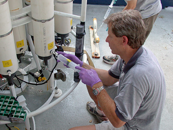
When the CTD and water sample bottles are hauled back on the ship, the researchers take the water samples and transfer them the ship’s laboratory. There they perform analyses to identify hydrothermal chemicals such as iron, manganese, methane and hydrogen. Depending on the concentrations of these elements in the water, they can tell if they are very close to a high-temperature vent. For instance, most of the iron from vents rapidly forms particles within the hydrothermal plume. More dissolved iron, compared to its particulate form, tells the scientists that they are probably within a few hundred meters or less of the seafloor vent.
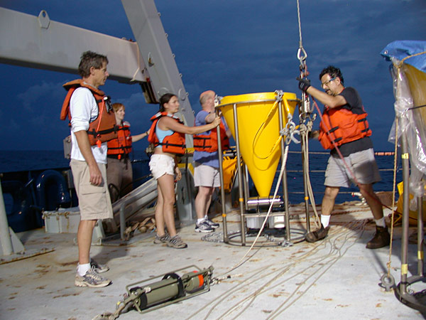
When the CTD ‘tow-yo’ data indicate that a vent site has been localized then it is time to deploy the submersible or ROV to photograph and collect samples. At this time geologists start mapping the site and biologists prepare to collect samples.
In the past few years, autonomous underwater vehicles (AUVs) like the ABE (Autonomous Benthis Explorer) have been equipped with CTDs and transmissometers and have been very successful in mapping hydrothermal plumes and finding seafloor vent sites along the mid-ocean ridges in the Lau Basin, western Pacific, the South Atlantic, and SW Indian Ocean. This newly developed technique promises to greatly expand scientists’ ability to find, map and sample new vents sites throughout the global ocean.
![]() Terms of Use · About us · Contact Us · Privacy · Sitemap
Terms of Use · About us · Contact Us · Privacy · Sitemap
Copyright Woods Hole Oceanographic Institution · Dive and Discover™ is a registered trademark of the Woods Hole Oceanographic Institution
With funding from the National Science Foundation, NOAA's Ocean Explorer Program, the National Marine Sanctuary Foundation, and WHOI's Deep Ocean Exploration Institute