
From Shelfbreak to Shoreline: Coastal Sea Level and Local Ocean Dynamics in the Northwest Atlantic
Camargo, C. M. L., Piecuch, C. G., & Raubenheimer, B. (2024). From Shelfbreak to Shoreline: Coastal Sea Level and Local Ocean Dynamics in the Northwest Atlantic. Geophysical Research Letters, 51(14), e2024GL109583. https://doi.org/10.1029/2024GL109583
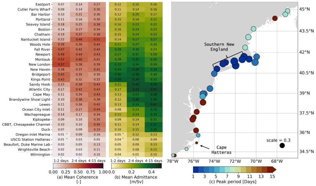
Image provided by Carolina Camargo
Mean magnitude-squared coherence (a, left) and admittance amplitude (b, middle) between Shelfbreak Jet transport and sea level at tide gauges ranging from Eastport, Maine (top row) down to Wrightsville Beach, North Carolina (last row), averaged between 1 to 2 days (left column), 2 to 4 days (middle column) and 4 to 15 days (right columns), with the tide gauges ordered following the coastline from north to south. Regional map (c, right) indicating the period (color) and magnitude (size) of maximum coherence. Key locations used for interpretation are indicated in the map. The figure shows that coherence and admittance between SBJ transport and individual tide-gauge records along the Northeastern United States have a clear frequency-dependent spatial structure.