
Image
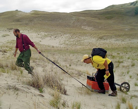
Dragging for Data
August 18, 2008WHOI coastal geologist Ilya Buynevich, right, and Lithuanian colleague Albertas Bitinas use ground-penetrating radar (GPR) to map ancient surfaces beneath Baltic Sea dunes. They are looking for “paleosols”—old soils buried under sand. These layers sometimes poke out as blackened ridgelines visible from the surface. More often, Buynevich and Bitinas find them with GPR signals that pierce the earth and reflect the historic patterns of climate change in Europe. (Woods Hole Oceanographic Institution)
Image and Visual Licensing
WHOI copyright digital assets (stills and video) contained on this website can be licensed for non-commercial use upon request and approval. Please contact WHOI Digital Assets at images@whoi.edu or (508) 289-2647.