
Multibeam sonar image of Galápagos seamounts
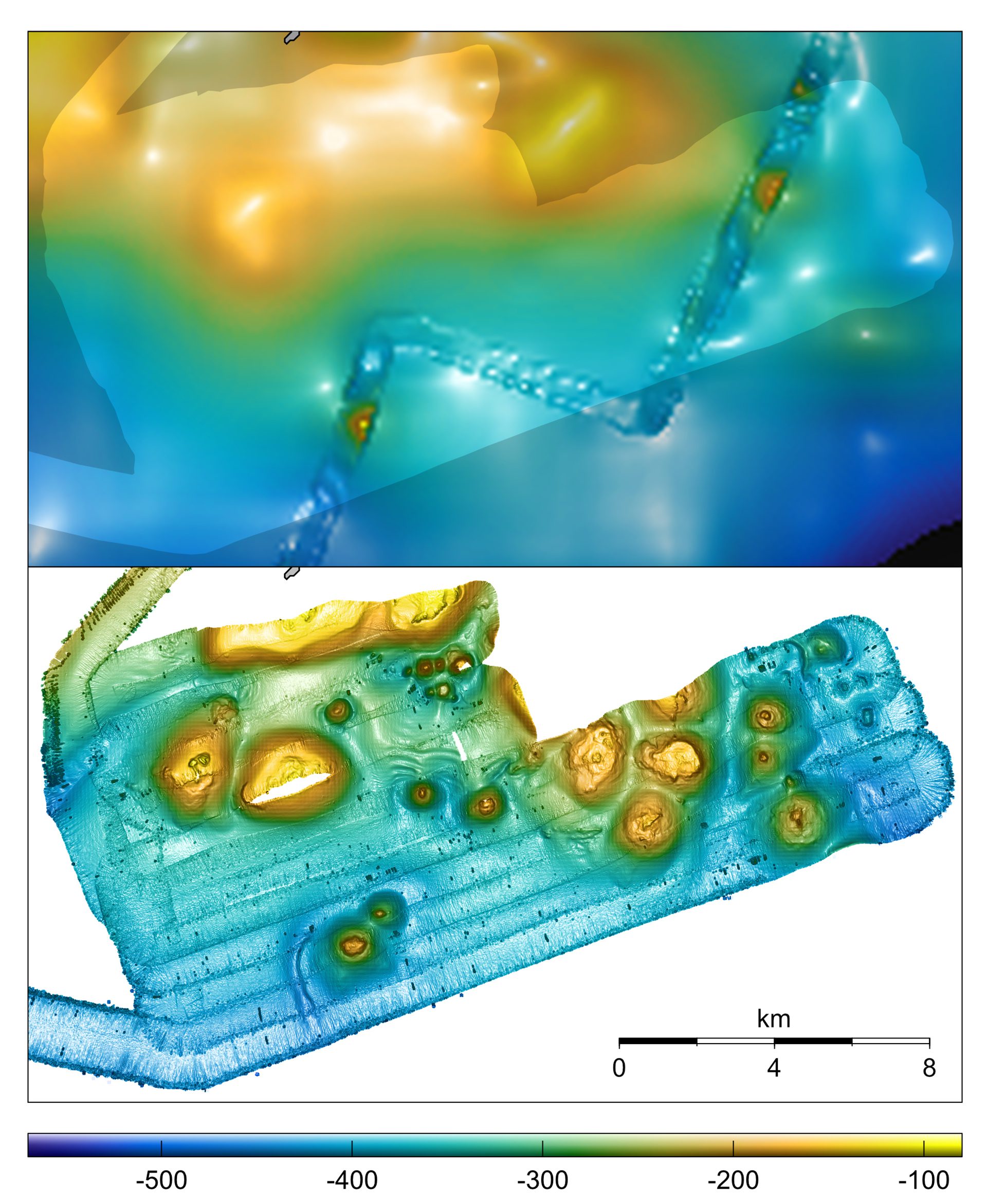
Multibeam sonar aboard the research vessel Alucia provided 1-meter-per-pixel resolution of seafloor bathymetry (bottom), compared with 800-meter-per-pixel resolution of the same area provided by satellite altimetry data (top) The higher resolution revealed clear images of seamounts from 650 to 10,000 feet in diameter and 325 to 1,000 feet in height. (Image courtesy of Adam Soule, © Woods Hole Oceanographic Institution)
Image and Visual Licensing
WHOI copyright digital assets (stills and video) contained on this website can be licensed for non-commercial use upon request and approval. Please contact WHOI Digital Assets at images@whoi.edu or (508) 289-2647.