
Illustration depicting the formation cycle of piteraq winds
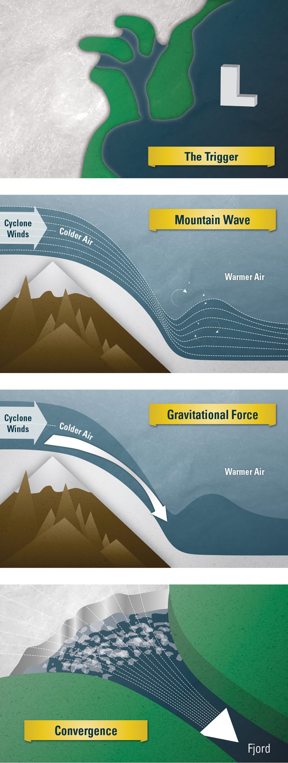
1) The trigger for piteraqs seems to be low-pressure systems, or cyclones, that tend to form frequently to the east and southeast of Greenland. Cyclonic winds from the northwest push a reservoir of cold air that forms over the ice sheet, sending it downhill in a jolt.
2) When the cold air rushes downhill, it creates a mountain wave, which occurs along the stratified boundary between colder, denser air masses and warmer, more buoyant air masses. The lower layer of colder air is squeezed into a smaller volume and then accelerates out of its confines, rushing downward along the steep slopes. It breaks, like a big wave of water that collapses and crashes onto the shore, creating a lot of turbulence.
3) A second driving force for piteraqs is gravity, which accelerates the speed of anything falling downhill, even a mass of cold air. Air speeds pick up, increasing the strength of the piteraq winds.
4) Other aspects of topography play a role in driving piteraqs. Tasiilaq is located inside a valley, which funnels the flow of cold air into a smaller and smaller space, increasing its velocity over the ice sheet and toward the fjord. By the time the air reaches the fjord, it shoots out at top speed. (Illustration by Eric S. Taylor, © Woods Hole Oceanographic Institution)
Image and Visual Licensing
WHOI copyright digital assets (stills and video) contained on this website can be licensed for non-commercial use upon request and approval. Please contact WHOI Digital Assets at images@whoi.edu or (508) 289-2647.