
Image
Sounding the Bottom
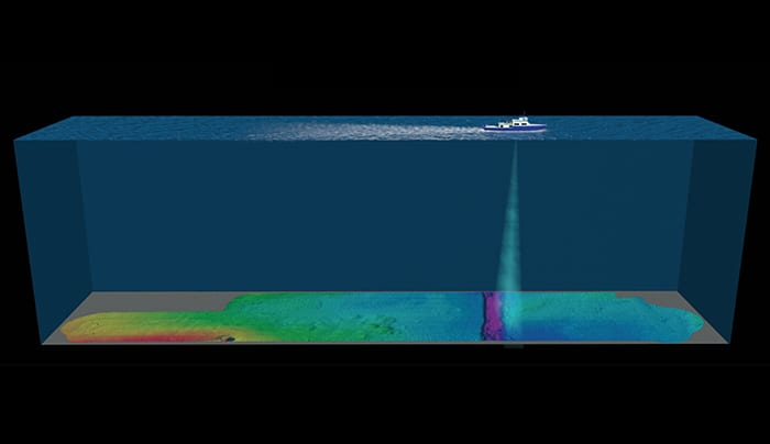
June 28, 2014One of the most powerful tools oceanographers use to map the bottom of the ocean is multibeam sonar, which uses sound waves to reveal the outline and surface characteristics of the seafloor. A transmitter mounted on the bottom of a research ship or underwater vehicle sends sound waves toward the bottom. The reflected sound waves are influenced by water temperature, as well as the shape and makeup of the reflecting surface, and used to create a map of seafloor topography and composition. WHOI scientists have used multibeam sonar to map everything from ocean basins to shipwrecks to lake floors engulfed by volcanic ash.(Illustration by Jack Cook, Woods Hole Oceanographic Institution)
Image and Visual Licensing
WHOI copyright digital assets (stills and video) contained on this website can be licensed for non-commercial use upon request and approval. Please contact WHOI Digital Assets at images@whoi.edu or (508) 289-2647.