
Geodynamics Program in Photos
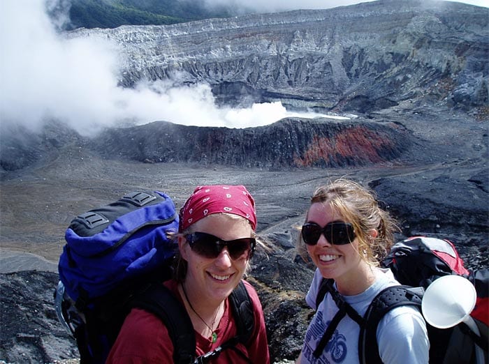
 Postdoctoral Fellow Nicole Keller and associate scientist Alison Shaw, both of the Department of Geology and Geophysics at WHOI, pause during their hike to the Poas volcano in Costa Rica in 2008. Behind them, gases vent from fumaroles in the dome of the volcano. They went to the area to collect samples of gases, fluids, and rocks for their study of how sulfur cycles through volcanic systems. Sulfur is exchanged between the oceans and atmosphere, then removed from the oceans via sedimentation, microbial processes, and alteration of minerals in the oceanic crust. The oceanic sediments and crust are then delivered to the mantle by tectonic processes. Some of the sulfur is eventually released back to the Earth's surface via volcanic activity. The goal of this project is to quantify how much of this sulfur is actually recycled. (Photo by Carlos Ramirez, University of Costa Rica)
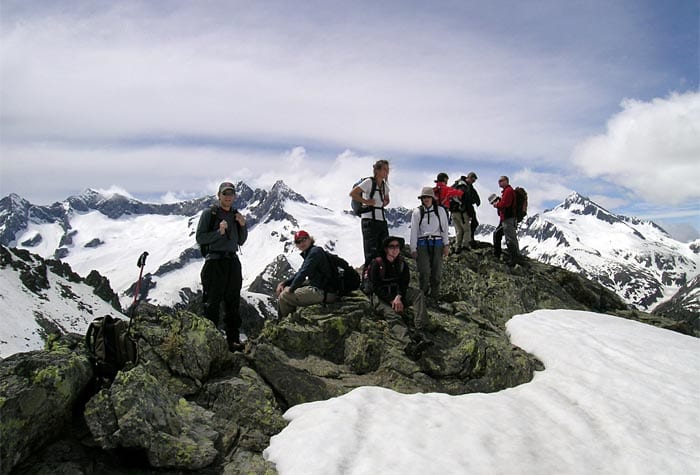
 WHOI scientists and students take a break while hiking to see the Ocean Crust Transition exposed in the Swiss and Italian Alps during the 2010 Geodynamics Study Tour. The field trip caps off the annual WHOI Geodynamics Program, a semester of weekly seminars on cutting-edge research on a particular earth sciences topic. In 2010, the program's focus was on Earth's crust—the most dynamic and complex geologic system on the planet. Although the crust of a planet is at the surface, it is often our only way to remotely study the geochemistry of planetary interiors. (Photo by Andrew Daly, Woods Hole Oceanographic Institution)
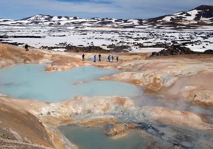
 MIT/WHOI graduate students and faculty explored a bubbling, sulfur-encrusted hot spring in June 2006 during an educational field trip to Iceland. The trip capped WHOI's Geodynamcs Program, a semester of weekly seminars by invited scientists on the cutting edge of research. (Photo by Chris Linder, Woods Hole Oceanographic Institution)
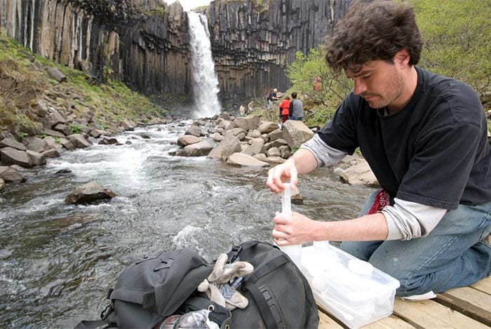
 MIT/WHOI graduate student Christian Miller takes a water sample just downstream from Svartifoss (Black Falls) in Skaftafell National Park, Iceland. Miller and two dozen students and scientists backpacked their way across Iceland's geologic and glacial features during the WHOI Geodynamics Field Trip in June 2006. (Photo by Chris Linder, Woods Hole Oceanographic Institution)
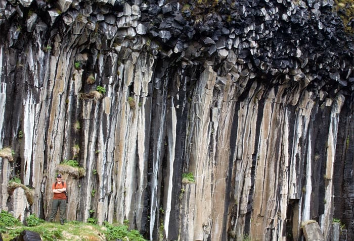
 MIT/WHOI Joint Program graduate student Mike Krawczynski is dwarfed by exposed columns of basalt in Skaftafell National Parkof Iceland. Krawczynski and two dozen colleagues visited the North Atlantic island nation in the summer of 2006 as part of the WHOI Geodynamics Program. After a semester of hard work and many hours in the classroom learning about the geological, geophysical, and climatological effects of ice, the students got a chance to see some up close. (Photo by Chris Linder, Woods Hole Oceanographic Institution)
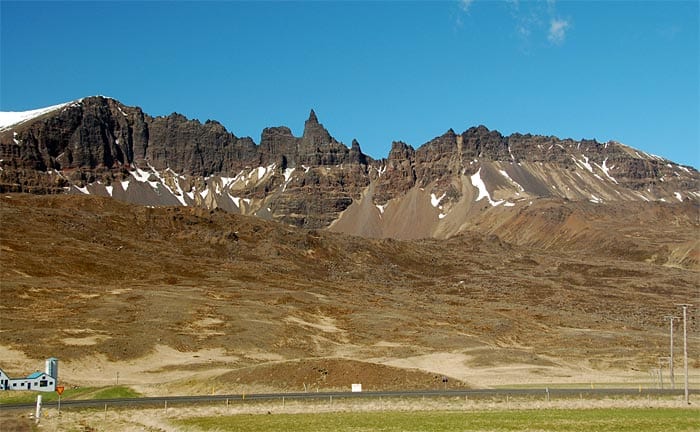
 Glaciated ridges tower over Route 1 and the Vatnsskarð mountain pass (west of Varmalið) in Iceland. WHOI students and scientists visited the region in June 2006 as the capstone on a semester-long Geodynamics program to study ice and its effects on the planet. (Photo by Mark Behn, Woods Hole Oceanographic Institution)
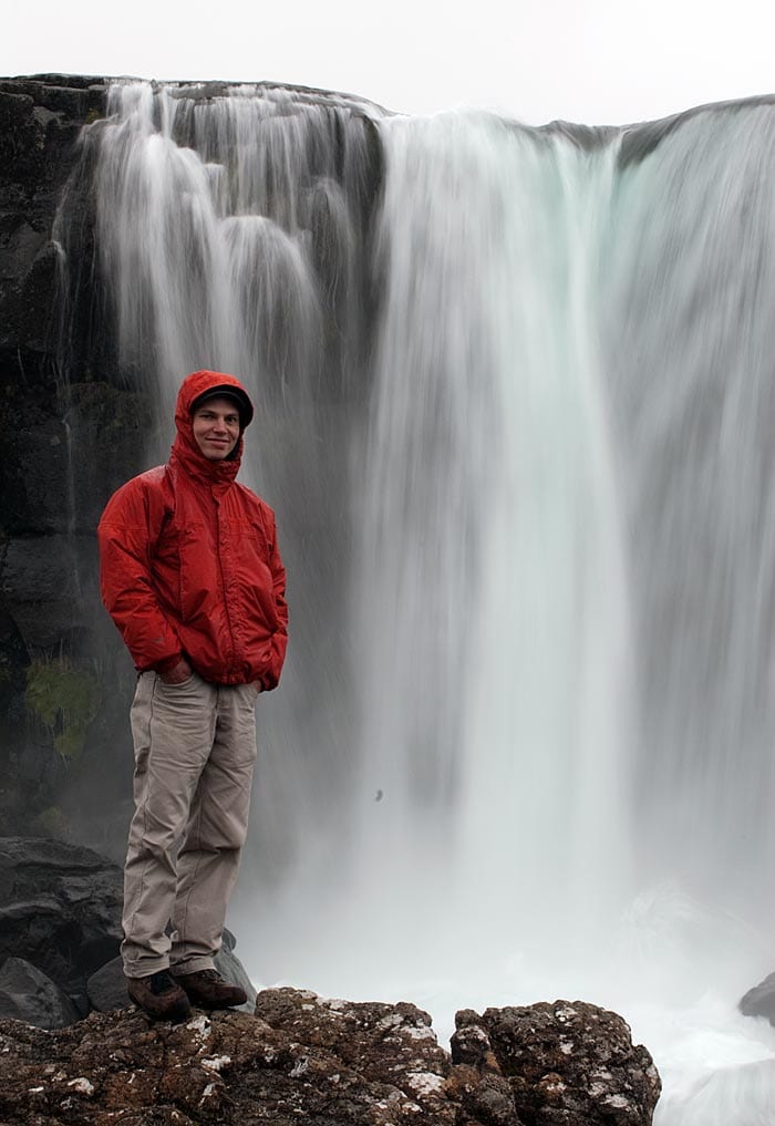
 MIT/WHOI Joint Program student Casey Saenger soaks up the mist of the Oxafoss waterfall in Thingvellir National Park during the spring 2006 Geodynamics Field Trip to Iceland. The field trips are the final chapter in a semester-long exploration of the changing, fluid Earth. (Photo by Chris Linder, Woods Hole Oceanographic Institution)
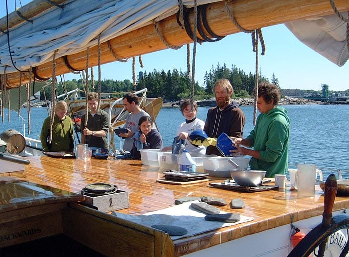
 MIT/WHOI Joint Program students wash dishes after a meal on a windjammer off the coast of Maine during the June 2007 field trip that capped the annual Geodynamics Seminar series. Pictured from left to right: Emily Roland, Chris Waters, Étienne Médard, Andrea Burke, Karin Lemkau, and two ship's crew members. (Photo by Jim Doutt, Woods Hole Oceanographic Institution)
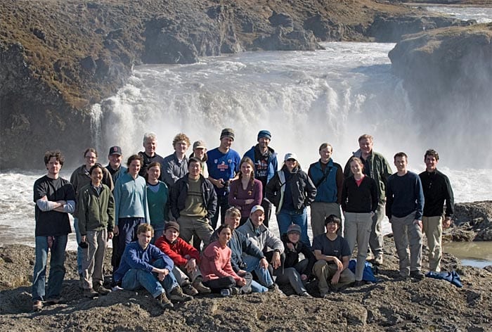
 Graduate students and scientists gather for a photo postcard from Godafoss, Iceland in June 2006. Every year, MIT/WHOI students in the Geodynamics Program make a field expedition to connect what they have studied in the classroom. (Photo by Chris Linder, Woods Hole Oceanographic Institution)
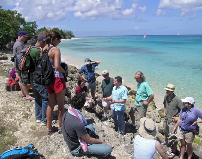
 WHOI's Bill Thompson (center) speaks with students in Barbados about sea level change during the 2009 Geodynamics Seminar, "Climate Change: Forcing, Responses, and Geo-engineering." Each year, the Geodynamics Seminar Program concludes with a trip to a location related to the program's geologic theme. Much of what is known today about the rate and magnitude of sea level change during the Quaternary Period (the most recent geological period of time in Earth's history) comes from studies by Thompson and others of coral reefs in Barbados and elsewhere. (Photo by Andrew Daly, Woods Hole Oceanographic Institution)
TOPICS: Underwater Volcanoes
Image and Visual Licensing
WHOI copyright digital assets (stills and video) contained on this website can be licensed for non-commercial use upon request and approval. Please contact WHOI Digital Assets at images@whoi.edu or (508) 289-2647.