WHOI prepares for 2019 Atlantic Hurricane Season
Researchers deploy autonomous underwater vehicles to improve forecasts
By Evan Lubofsky | July 18, 2019
Hurricane Florence. Image courtesy of NASA.
With the 2019 Atlantic Hurricane season underway, Woods Hole Oceanographic Institution (WHOI) is prepared to supply important ocean data that can help hurricane forecasters predict the strength of this year’s coming storms.
According to the National Oceanic and Atmospheric Administration (NOAA), this year’s hurricane season is projected to have a forty percent chance of being ‘near-normal’ with nine to fifteen named storms and two to four major hurricanes. To help gauge the strength or “intensity” of these storms, WHOI researchers have mobilized autonomous underwater vehicles (AUVs) and other instruments to measure changes occurring in the ocean before and during storms, and to transmit the data in near-real time.
“As a sea-going institution, WHOI has a long history of collecting ocean measurements,” said Robert Todd, an associate scientist in the Physical Oceanography Department. “In recent years, advances in autonomous technologies and satellite communication have made it possible for us to provide key ocean measurements to weather forecasting centers like the National Hurricane Center, even in the middle of hurricanes when ships and people cannot be safely at sea. These measurements help weather models better capture the ocean-atmosphere feedbacks that are critical to accurate storm forecasting.”
Gliding beneath the storm
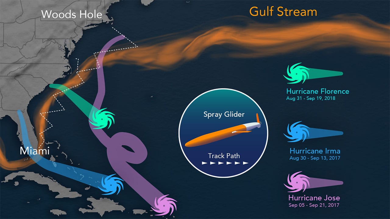
Todd relies on AUVs known as Spray gliders to track changing ocean conditions in the Gulf Stream, a warm water ocean current that runs northward along the U.S. East Coast. These human-sized, underwater vehicles are routinely deployed offshore near Miami, Florida and zig-zag their way back and forth across the Gulf Stream as it carries them northward towards Woods Hole, Massachusetts. The journey for each glider takes about four months. As they head north, the gliders dive thousands of feet and measure seawater temperature, salinity, and current velocities as they ascend back to the surface. Upon surfacing every few hours, they automatically transmit their data via satellite to Todd’s lab at WHOI, where he and his colleagues relay them to forecasters.
Heat is a critical ingredient in the formation of hurricanes, which thrive on warm waters at the ocean’s surface. This year, sea surface temperatures in the tropical Atlantic Ocean and Caribbean Sea are expected to be warmer than average, according to NOAA’s Climate Prediction Center.
“Forecasts of hurricane tracks several days ahead have become quite accurate in recent years as models of atmospheric circulation have improved,” said Todd. But he says improvements in the forecasts of hurricane intensity has lagged behind since hurricane intensity depends, in large part, on the amount of heat (energy) available in the ocean below the storm. “Satellites provide us with important measurements of temperature in the upper few inches of the ocean, but tell us relatively little about the total heat available to fuel storm development. For that, we need instruments making measurement directly in the ocean,” he said.
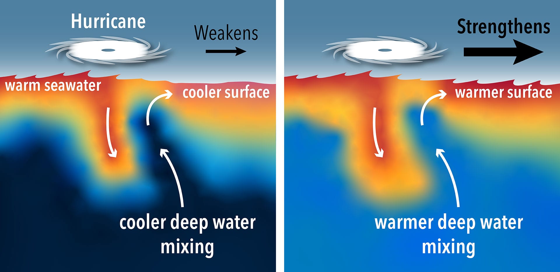
By measuring ocean temperatures at depths that satellites can’t penetrate, gliders can help researchers determine if the warm layer of water at the ocean’s surface is blanketing additional warm water below—which would fuel stronger hurricanes—or if cold water lies beneath. In the latter case, the cooler water would mix with the warm surface water, reduce its temperature, and choke off a storm’s energy supply.
One of the key advantages Spray gliders offer is their ability to work autonomously. This enables researchers to collect critical ocean data in locations that would be too dangerous for ships to travel in during a hurricane.
Additional observations
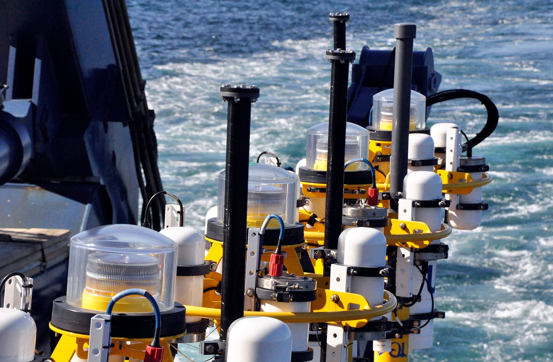
WHOI researchers are also relying on an ocean observatory deployed off the edge of the continental shelf off New England—an area where hurricanes often pass through between June and November each year. Known as the Ocean Observatories Initiative Pioneer Array, the network of instruments includes sensor-equipped moored profilers that measure seawater temperature and salinity, and AUVs that monitor various layers of the ocean. While the array’s primary function is to measure nutrient and carbon cycling over the biologically-productive shelf break, it’s location makes it ideally suited for monitoring ocean conditions during hurricanes.
“The Pioneer Array enables us to obtain important subsurface measurements that are high-resolution in both time and space,” said Glen Gawarkiewicz, a senior scientist at WHOI. “The ocean’s response to hurricanes is complex, particularly in frontal zones where different water masses interact. Understanding how the ocean surface temperature evolves is an important step in the difficult challenge of forecasting hurricane intensity before it makes landfall.”
By providing a detailed view of how ocean conditions affect hurricane strength this season, WHOI researchers expect to improve intensity forecasting, which will provide better guidance for emergency responders and allow coastal communities to better prepare for impacts should a major storm occur.
This work is funded by the National Oceanic and Atmospheric Administration (NOAA), the National Science Foundation (NSF), the Office of Naval Research (ONR), Eastman, and Woods Hole Oceanographic Institution (WHOI). The Woods Hole Oceanographic Institution is a private, non-profit organization on Cape Cod, Mass., dedicated to marine research, engineering, and higher education. Established in 1930 on a recommendation from the National Academy of Sciences, its primary mission is to understand the ocean and its interaction with the Earth as a whole, and to communicate a basic understanding of the ocean’s role in the changing global environment. For more information, please visit www.whoi.edu.
A Spray glider is deployed off the coast of Miami to monitor the Gulf Stream at different depths up through New England. The vehicle measures changes which occur in the ocean just before and during Atlantic hurricanes. The glider then transmits the data in near-real time to hurricane forecasters standing by.


