Monster hurricanes reached U.S. during prehistoric periods of ocean warming
February 11, 2015
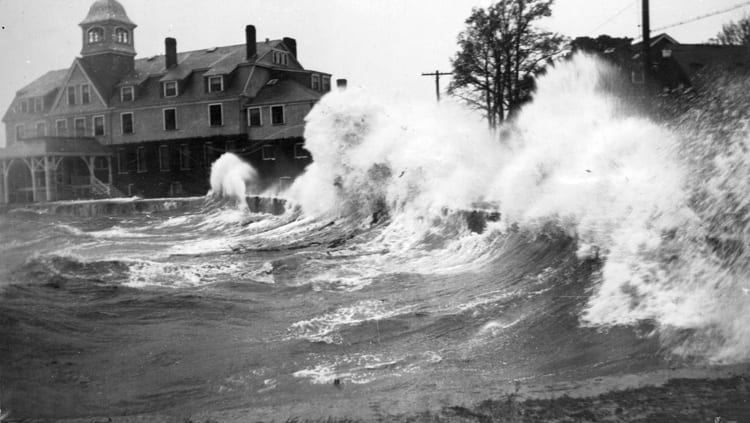
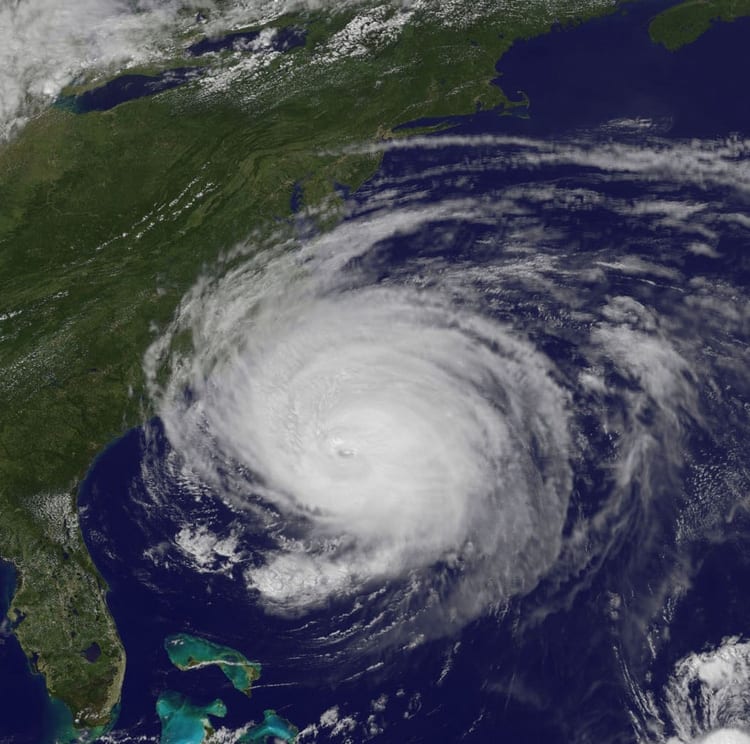
Intense hurricanes, possibly more powerful than any storms New England has experienced in recorded history, frequently pounded the region during the first millennium, from the peak of the Roman Empire into the height of the Middle Ages, according to a new study. The findings could have implications for the intensity and frequency of hurricanes the U.S. could experience as ocean temperatures increase as a result of climate change, according to the study’s authors.
A new record of sediment deposits from Cape Cod, Mass., show evidence that 23 severe hurricanes hit New England between the years 250 and 1150, the equivalent of a severe storm about once every 40 years on average. Many of these hurricanes were likely more intense than any that have hit the area in recorded history, according to the study. The prehistoric hurricanes were likely category 3 storms – like Hurricane Katrina — or category 4 storms – like Hurricane Hugo — that would be catastrophic if they hit the region today, according to Jeff Donnelly, a scientist at Woods Hole Oceanographic Institution (WHOI) in Massachusetts and lead author of the study published in Earth’s Future, a journal of the American Geophysical Union.
The study is the first to find evidence of historically unprecedented hurricane activity along the northern East Coast of the United States, Donnelly said. It also extends the hurricane record for the region by hundreds of years, back to the first century, he said.
“These records suggest that the pre-historical interval was unlike what we’ve seen in the last few hundred years,” said Donnelly.
The most powerful storm to hit Cape Cod in recent history was Hurricane Bob in 1991, a category 2 storm that was one of the costliest in New England history. Storms of that intensity have only reached the region three times since the 1600s, according to Donnelly.
The intense prehistoric hurricanes documented by the study were fueled in part by warmer sea surface temperatures in the Atlantic Ocean during the ancient period investigated in the study than have been the norm off the U.S. East Coast over the last few hundred years. However, as oceans temperatures have slowly inched upward in recent decades, the tropical North Atlantic sea surface has surpassed the warmth of prehistoric levels and is expected to warm further over the next century as the climate heats up, Donnelly said.
He said the new study could help scientists better predict the frequency and intensity of hurricanes that could hit the U.S. coast in the future.
“We hope this study broadens our sense of what is possible and what we should expect in a warmer climate,” Donnelly said. “We may need to begin planning for a category 3 hurricane landfall every decade or so rather than every 100 or 200 years.”
“The risk may be much greater than we anticipated,” he added.
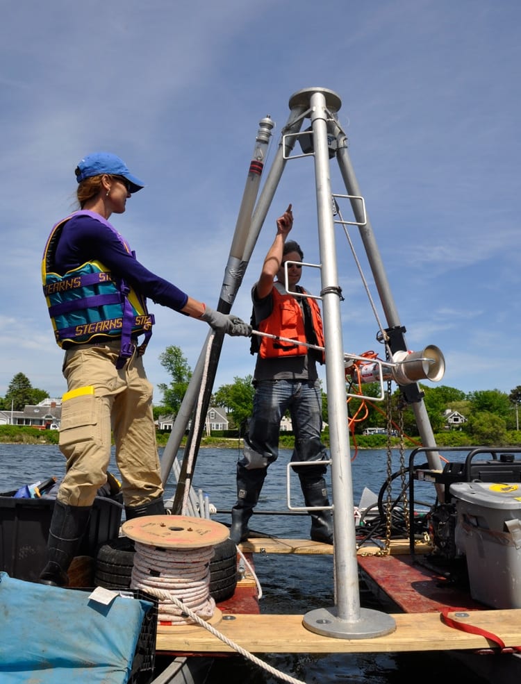
Donnelly and his colleagues examined sediment deposits from Salt Pond near Falmouth on Cape Cod. The pond is separated from the ocean by a 1.3- to 1.8-meter (4.3- to 5.9-foot-) high sand barrier. Over hundreds of years, strong hurricanes have deposited sediment over the barrier and into the pond where it has remained undisturbed.
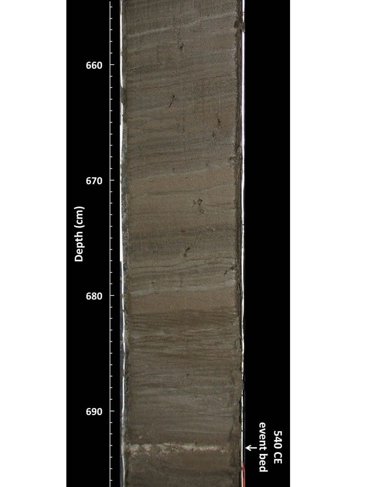
The researchers extracted nine-meter (30-foot) deep sediment cores that they then analyzed in a laboratory. Similar to reading a tree ring to tell the age of a tree and the climate conditions that existed in a given year, scientists can read the sediment cores to tell when intense hurricanes occurred.
The study’s authors found evidence of 32 prehistoric hurricanes, along with the remains of three documented storms that occurred in 1991, 1675 and 1635.
The prehistoric sediments showed that there were two periods of elevated intense hurricane activity on Cape Cod – from 150 to 1150 and 1400 to 1675. The earlier period of powerful hurricane activity matched previous studies that found evidence of high hurricane activity during the same period in more southerly areas of the western North Atlantic Ocean basin – from the Caribbean to the Gulf Coast. The new study suggests that many powerful storms spawned in the tropical Atlantic between 250 and 1150 also battered the US East Coast.
The deposits revealed that these early storms were more frequent, and in some cases were likely more intense, than the most severe hurricanes Cape Cod has seen in historical times, including Hurricane Bob in 1991 and a 1635 hurricane that generated a 20-foot storm surge, according to Donnelly.
High hurricane activity continued in the Caribbean and Gulf of Mexico until 1400, although there was a lull in hurricane activity during this time in New England, according to the new study. A shift in hurricane activity in the North Atlantic occurred around 1400 when activity picked up from the Bahamas to New England until about 1675.
The periods of intense hurricanes uncovered by the new research were driven in part by intervals of warm sea surface temperatures that previous research has shown occurred during these time periods, according to the study. Previous research has also shown that warmer ocean surface temperatures fuel more powerful storms.
The sediment coring and analysis by Donnelly and his colleagues “is really nice work because it gives us a much longer period perspective on hurricanes,” said Kerry Emanuel, a professor of atmospheric science at the Massachusetts Institute of Technology in Cambridge. “It gives you something that you otherwise wouldn’t have any knowledge of.”
“The ability to produce and synthesize thousands of years of data on hurricane paths and frequencies is revolutionizing our understanding of what controls where and how often these dangerous storms make landfall,” said Candace Major, program director in the National Science Foundation’s Division of Ocean Sciences, which funded the research.
In addition to Donnelly, the research team included colleagues from the University of North Carolina, Wilmington; University of Massachusetts, Amherst; University of Wyoming, Laramie; University of Texas, Austin; and Texas A&M University, Galveston. The work was funded by the National Science Foundation, Bermuda Institute for Ocean Sciences, the U.S. Dept. of Energy, NOAA, and the Dalio Explore Fund at WHOI.
The Woods Hole Oceanographic Institution is a private, non-profit organization on Cape Cod, Mass., dedicated to marine research, engineering, and higher education. Established in 1930 on a recommendation from the National Academy of Sciences, its primary mission is to understand the ocean and its interaction with the Earth as a whole, and to communicate a basic understanding of the ocean’s role in the changing global environment. For more information, please visit www.whoi.edu.


