
Researchers improve satellite surveillance of emperor penguins
 A group of emperor penguin chicks make their way across the Antarctic ice sheet. (Photo by: Céline Le Bohec)
 May 29, 2024
New method will provide accurate counts and breeding success of the threatened species in the light of climate change
Images and video available for use with credit can be found here.
Woods Hole, Mass – Monitoring the global population of emperor penguins is a major challenge. Not only do they inhabit Antarctica’s harsh, remote environment, their colony occupancy also fluctuates based on a series of factors. A new study published in Nature Communications, “Remote sensing of emperor penguin abundance and breeding success,” draws attention to these challenges and presents a method that can accurately predict the number of breeding pairs as well as fledging chicks.
Over the last two decades, researchers have been using satellite imagery, among other technologies, as means for keeping track of this threatened species. While it has provided valuable population data, the counts to date are still inconsistent and unreliable for a variety of reasons. The first is that satellite images can only be taken between October and April, otherwise there isn’t enough light to capture the species at their breeding sites, mostly on sea ice. Another challenge of satellite imagery is that the number of penguins present at a colony can highly vary, as adults may come and go. It also cannot capture chicks.
What this new method accomplishes is to use satellite imagery in conjunction with a phenological and a behavioral model.
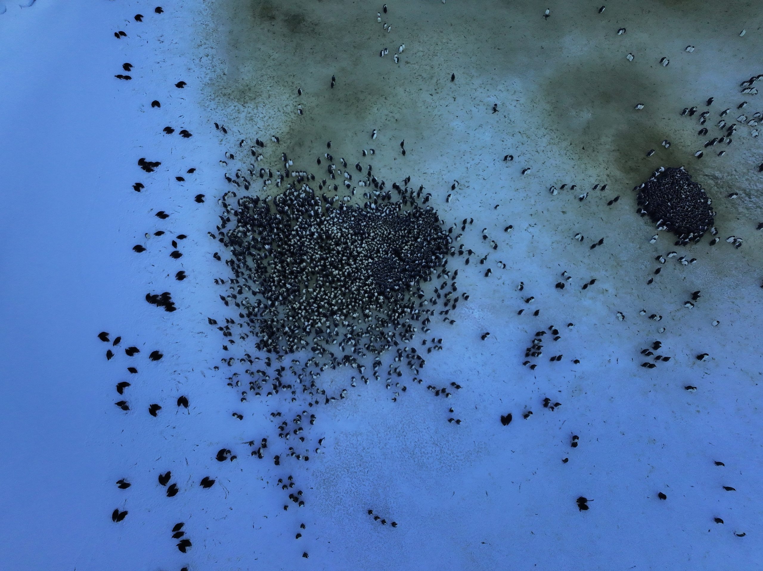
A satellite image of an emperor penguin colony near Neumayer Station, Antarctica.
“This means taking into consideration seasonal and conditional occurrences that may be taking place at the time a satellite image is captured. When it comes to emperor penguins, those include events such as the currently perceived penguin temperature, comparable to the windchill temperature for humans, and foraging efforts,” said Daniel Zitterbart, one of the study’s senior authors and an associate scientist at Woods Hole Oceanographic Institution (WHOI). “We tested these phenological and behavioral models for periods of three and four years in two different colonies.”
The estimated counts from the satellite imagery were compared to a dataset collected over a 10 year period at the Pointe Géologie colony. Céline Le Bohec, a senior author of the study from CNRS-France and Scientific Centre of Monaco, whose team collected this dataset, emphasizes the importance of long-term, systematic time series for understanding and predicting the impacts of global changes.
“Systematic data collection on the biological component of ecosystems is still in its infancy, especially in harsh environments, in which consistent and repeatable research is particularly hard to achieve,” Le Bohec said. “In the coming years, climate change, fishing and other human interference in emperor penguin’s habitat will put the species ability to adapt under harsh pressure. This scarcity still constitutes a critical knowledge gap, and getting this methodology correct in a timely manner for emperor penguins will help to protect them.”
The study’s lead author, Alexander Winterl, a PhD candidate at Friedrich-Alexander Universität Erlangen-Nürnberg, says he hopes these new population counts will contribute to more accurate predictions and inform policy.
“The rapid decline of ice on and around Antarctica threatens their livelihood.” Winterl said. “Previous studies suggest that over 90% of the emperor penguin colonies will disappear by 2100 without major cuts in greenhouse gas emissions. We need to have accurate population data to make people aware of these extreme changes in the Southern Ocean, not only to protect these seabirds, but to draw awareness to the overarching impacts of climate change.”
An emperor penguin colony in Adélie Land, Antarctica. ©Woods Hole Oceanographic Institution
“Emperor penguins are at the top of the food web.They are a reflection of how lower levels of the marine food web are being impacted,” Zitterbart said. “This research has the potential to transform the emperor penguin from a hard-to-study species to the canary in a coal mine of the Southern Ocean and act as an early warning system for ecosystem health. Using this new method, our next goal is to use annual satellite imagery to get accurate population counts and breeding success in all 66 emperor penguin colonies known to date.”
This research was supported by the National Science Foundation, Woods Hole Oceanographic Institution, the German Research Foundation, Institut Polaire Français Paul-Emile Victor, Centre Scientifique de Monaco, Centre National de la Recherche Scientifique, and the Alfred Wegener Institute Helmholtz Centre for Polar and Marine Research (AWI).
###
About Woods Hole Oceanographic Institution
The Woods Hole Oceanographic Institution (WHOI) is a private, non-profit organization on Cape Cod, Massachusetts, dedicated to marine research, engineering, and higher education. Established in 1930, its primary mission is to understand the ocean and its interaction with the Earth as a whole, and to communicate an understanding of the ocean’s role in the changing global environment. WHOI’s pioneering discoveries stem from an ideal combination of science and engineering—one that has made it one of the most trusted and technically advanced leaders in basic and applied ocean research and exploration anywhere. WHOI is known for its multidisciplinary approach, superior ship operations, and unparalleled deep-sea robotics capabilities. We play a leading role in ocean observation and operate the most extensive suite of data-gathering platforms in the world. Top scientists, engineers, and students collaborate on more than 800 concurrent projects worldwide—both above and below the waves—pushing the boundaries of knowledge and possibility. For more information, please visit www.whoi.edu.
Key Takeaways
- New phenological and behavioral models will help scientists collect more accurate counts of emperor penguins.
- Emperor penguins are at the top of the food web.They are a reflection of how lower levels of the marine food web are being impacted by climate change.
- Systematic data collection on the biological component of ecosystems is still in its infancy, especially in harsh environments, in which consistent and repeatable research is particularly hard to achieve.