 |
|
Rationale for an Oceanic Mantle Dynamics (OMD) Initiative Elements of the OMD Initiative Oceanic Mantle
|
|
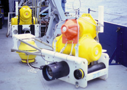
Rationale for an Oceanic Mantle Dynamics (OMD) Initiative In recent years, many models of flow in the upper mantle beneath the oceans have been developed including plume upwelling and swell formation at hotspots, small-scale convection beneath plates, mantle flow and melt migration beneath fast and slow spreading centers, channelized flow from hotspots to spreading centers, convective overturn above subducting plates, asthenospheric flow associated with propagating rifts, downwelling beneath the Australian-Antarctic discordance, return flow from trenches to ridges, and flow around subducting slabs during trench rollback. These models have been based on and designed to explain observations of features at the Earth's surface, such as bathymetry, gravity and geoid fields, plate kinematics, and the composition of the melt products of upwelling beneath island arcs, back-arc basins, mid-ocean ridges and intraplate volcanic centers. Now, for the first time, we are entering an era when these theoretical models of flow can be tested and refined with measurements that have the power to resolve subsurface structure at critical length scales. Although much progress has been made on developing global tomographic models of seismic structure, lateral resolution in the best of the these models is still on the order of 500-1000 km or more; much too long to provide the critical tests of models that predict variations on scales of tens to hundreds of kilometers. In the last decade, PASSCAL and other similar array deployments of broadband seismometers on land have revolutionized the study of crustal and mantle processes beneath the continents. Beneath the oceans, high resolution images have been obtained in only a few areas where stations can be placed on islands and/or there are local deep earthquake sources, such as beneath Iceland or the Tonga/Fiji region. Recent experiments such as MELT (Mantle Electromagnetic and Tomography) and LABATTS (Lau-Basin Tonga Trench Seismic) have demonstrated the feasibility of long deployments of ocean-bottom seismometers (OBSs) in PASSCAL-like arrays. These experiments were the first in the oceans to study earth structure using passive arrays and conventional earthquake seismology techniques such as surface and body wave tomography, shear wave splitting, and receiver function analysis. Further improvements in instrumentation planned and under development will expand the possible types and quality of observations. Now, with the establishment of a U.S. National OBS Instrumentation Pool with a total of more than 100 long-duration, intermediate-band OBSs available for use by the broader geophysical community (see Appendix 1), there is a tremendous opportunity for dramatic progress in understanding upper mantle processes beneath the oceans. The purpose of the Oceanic Mantle Dynamics (OMD) Program is to develop an organized community program of research within NSF’s Marine Geology and Geophysics Program focused on problems of flow in the oceanic upper mantle. A multidisciplinary approach centered on experiments made possible by the new OBS instrumentation pool and incorporating constraints from petrology, geochemistry and theoretical modeling of geodynamic processes could go far toward testing and refining models of mantle flow developed in the three decades since the plate tectonic revolution. The intent is that the OMD Program will involve scientists with a broad range of backgrounds, drawing from both the earth and ocean science communities. In many ways, this initiative will be complementary to EARTHSCOPE, and the planned USArray, which will provide unprecedented imaging of the upper mantle beneath North America. In addition to providing comparable imaging of critical areas in the oceans, the OMD Program will help fill in gaps in global coverage and in conjunction with USArray deployments could probe the deep structure underlying ocean-continent transitions. |
 |
|
