
Research Highlights
Oceanus Magazine
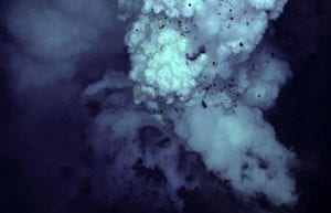
Through the camera eyes of the undersea vehicle Jason, scientists were investigating a quietly bubbling pit on the side of a large volcano on the seafloor south of Japan in April. Then the volcano erupted. Jason’s cameras captured the pit,…
Towing an underwater video microscope across the Atlantic Ocean, two scientists found unexpected abundances of colonial cyanobacteria that fertilize the oceans with nitrogen. The bacteria may turn out to be “a crucial component” that stimulates the growth of plants and…
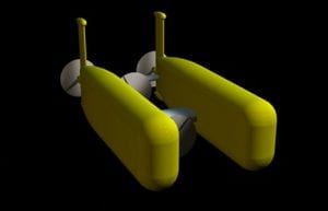
Nereus—a mythical god with a fish tail and a man’s torso—was chosen Sunday (June 25) in a nationwide contest as the name of a first-of-its-kind, deep-sea vehicle under construction at the Woods Hole Oceanographic Institution. The vehicle, known until now…
Graduate student Anna Michel is adapting laser technology to the murky fluid environment and crushing pressures at depths of 11,000 feet. The goal is to develop an instrument that can directly measure the many elements spewing from hydrothermal vents just as they emerge from Earth?s crust.
News Releases
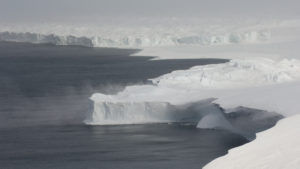
SAMS will operate autonomously for years in hostile, difficult-to-reach locations that are Ground Zero for global sea-level rise

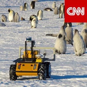
New method will provide accurate counts and breeding success of the threatened species in the light of climate change
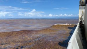
Findings could lead to locating nutrient sources and providing management options
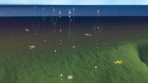
The OOI collects and serves measurements from more than 900 autonomous instruments on the seafloor and on moored and free-swimming platforms.
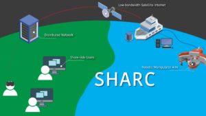
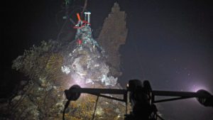
The Shared Autonomy for Remote Collaboration (SHARC) framework “enables remote participants to conduct shipboard operations and control robotic manipulators.
News & Insights
Fishing community and OOI scientists unite to study how the ocean is changing & what it means for global fishing industries
NSF program fosters collaboration between indigenous communities and traditional scientists, allowing WHOI’s autonomous vehicles to shed light on a changing Arctic
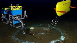
An investigative report this week in the LA Times features the work of WHOI’s marine geochemistry lab in identifying the discarded barrels and analyzing samples from the discovery.
DUNEX is a multi-agency, academic and stakeholder collaborative community experiment to study nearshore processes during coastal storms. Use this ArcGIS map to learn more about all the project sites along the North Carolina coastline.