
Research Highlights
Oceanus Magazine
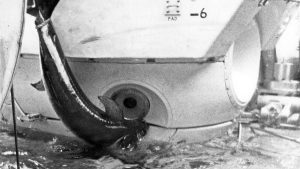
During a 1967 dive off Florida, a startled swordfish rammed the famed submersible Alvin—lodging its sword in the hull and forcing the crew to abort the mission
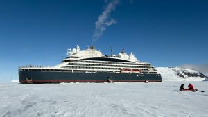
A new partnership gives scientists rare access to remote Antarctic glaciers—and a new way to engage the public
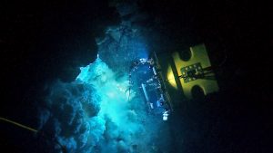
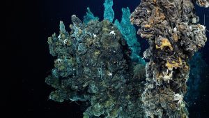
Jason, Mesobot, and Nereid Under Ice are transforming our understanding of underwater volcanoes and the life they support.
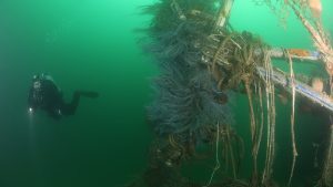
WHOI’s ResQ ROV to clean up debris in prominent marine heritage sites
News Releases
Ying-Tsong Lin is the 12th person in history and the first person of Asian descent to visit ocean’s deepest seafloor A Woods Hole Oceanographic Institution researcher became one of just a handful of people to visit the deepest part of…
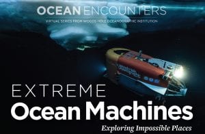
On May 20, ocean explorer and world-renowned filmmaker James Cameron will host a special edition of Ocean Encounters, a popular virtual event series from Woods Hole Oceanographic Institution.
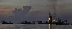
Ten years after the Deepwater Horizon explosion caused the largest accidental marine oil spill in history, WHOI marine geochemists Elizabeth Kujawinski and Christopher Reddy review what they— and their science colleagues from around the world—have learned.
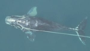
The funding provided by the SeaWorld Conservation Fund will be primarily used to test alternative non-lethal fishing gear. Whales and sea turtles commonly entangle in ropes that connect crab or lobster traps on the sea floor to buoys on the sea surface.
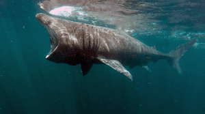
An autonomous underwater vehicle (AUV) known as the REMUS SharkCam has been used in the UK for the first time to observe the behaviour of basking sharks in the Inner Hebrides, off the west coast of Scotland.
News & Insights
NSF program fosters collaboration between indigenous communities and traditional scientists, allowing WHOI’s autonomous vehicles to shed light on a changing Arctic
An investigative report this week in the LA Times features the work of WHOI’s marine geochemistry lab in identifying the discarded barrels and analyzing samples from the discovery.