
Research Highlights
Oceanus Magazine
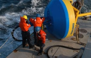
The Deep-ocean Assessment and Reporting (DART) system is battle-tested and operational, so it makes sense to use such buoys to address the immediate need for a tsunami network. Researchers at WHOI are concentrating on the next generation of multidisciplinary ocean observing platforms.
Since the great Indonesian earthquake and tsunami of December 26, 2004, policy-makers and scientists around the globe have been embracing a rare moment of public attention on the oceans, accelerating plans to create a comprehensive tsunami-warning network and to make citizens better prepared for the next massive wave. Another potent earthquake along the same fault on March 28, 2005, has increased that sense of urgency.
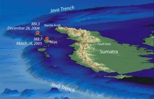
If any good has come from the recent devastating earthquakes off Sumatra, it is that they are providing scientists with unprecedented clues to understanding how these large undersea earthquakes occur and how they create tsunamis.
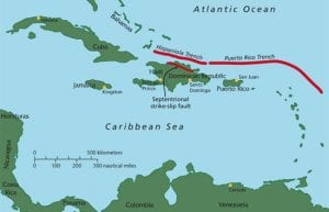
In a study published Dec. 24, 2004, in the Journal of Geophysical Research, Woods Hole geologists Uri ten Brink and Jian Lin reported a heightened earthquake risk from the Septentrional fault zone, which cuts through the highly populated Cibao valley in the Dominican Republic.
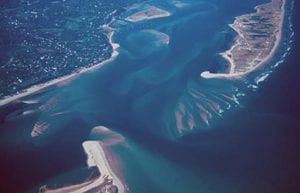
Changes to the shoreline are inevitable and inescapable. Shoals and sandbars become islands and then sandbars again. Ice sheets grow and shrink, causing sea level to fall and rise as water moves from the oceans to the ice caps and back to the oceans. Barrier islands rise from the seafloor, are chopped by inlets, and retreat toward the mainland. Even the calmest of seas are constantly moving water, sand, and mud toward and away from the shore, and establishing new shorelines.
News Releases
A new study investigates how the influence of low gravity, as found on ocean worlds in our solar system, impacts flow of water and heat below their seafloors.
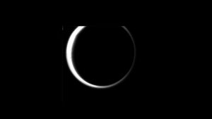
MIT, Woods Hole Oceanographic Institution researchers find wave activity on Saturn’s largest moon may be strong enough to erode the coastlines of lakes and seas.

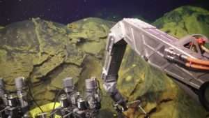
Ocean scientists discovered the new deep-sea hydrothermal vent sites on the seafloor at 2,550 meters (8366 feet, or 1.6 miles) depth.
Woods Hole, MA – A team of scientists led by a Tulane University oceanographer and the Woods Hole Oceanographic Institution (WHOI) has found that deposits deep under the ocean floor reveal a way to measure the ocean oxygen level and […]
Woods Hole, Mass. -Evidence of climate change in the North Atlantic during the last 1,000 years can be seen in the deep ocean, according to a newly published paper led by researchers from the Woods Hole Oceanographic Institution (WHOI) and […]
News & Insights
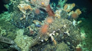
In April 2023, scientists diving in the human-occupied submersible Alvin discovered extensive, ancient deep-sea coral reefs within the Galápagos Marine Reserve.

This week, NASA’s Perseverance Rover lands on Mars to continue the search for life on the Red Planet. At the same time, WHOI scientists and engineers are applying their experience exploring the deepest parts of planet Earth to the quest […]
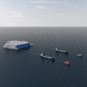
WHOI researchers are now investigating the feasibility of towing icebergs to alleviate water shortages.

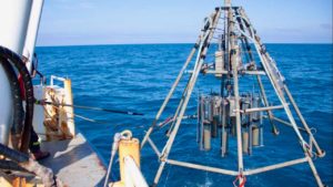
Ocean scientists leverage game-changing technologies to improve our understanding of the global ocean’s most dangerous earthquake faults and enable more advanced warnings for seismic risk.
As glaciers melt at unprecedented rates, WHOI’s Simon Pendleton is looking back to historical records to predict whether this new cool runoff will slow ocean circulation and cool the northern hemisphere––findings which could mean adjustments to some climate predictions.